
Manizales – Villa Maria – Potosí – Laguna del Otún – Potosí – Cabañas de Brisas – Termalez de Ruiz – Manizales
There’s just time to squeeze in one more bikepack before I head back to New Mexico…
Lying a few hundred kilometres west of Bogota, and jutting high above the surrounding coffee plantations of Colombia’s Zona Cafetera, I plan my trip to Los Nevados between a visit to Medellin’s Sunday Ciclovia, and the capital’s car-free Earth Day. This four day adventure in the Cordillera Central of the Colombian Andes is shared with fellow backcountry enthusiast Nick Gault (be sure to check out his epic paddle around the Darien Gap), and inspired by the dirt road explorations of The Ride South.
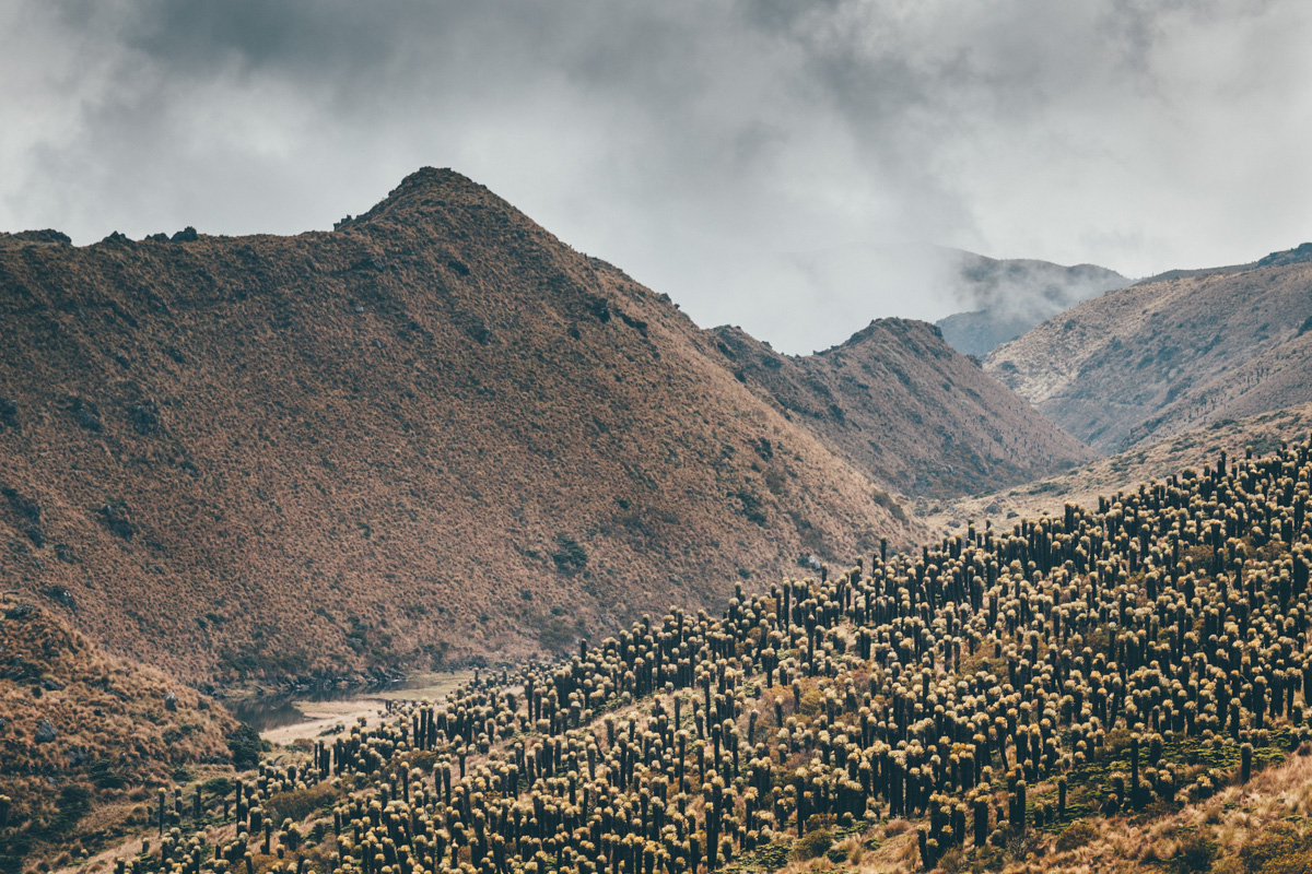
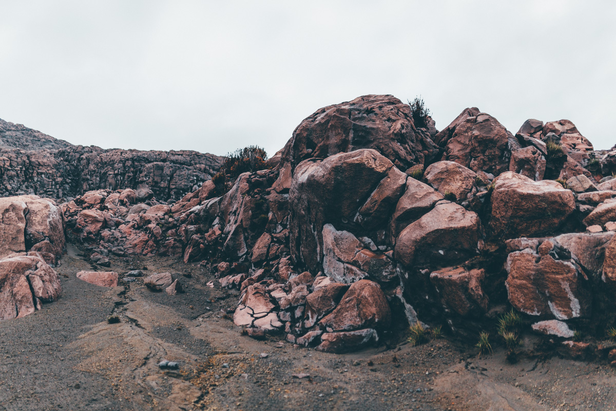
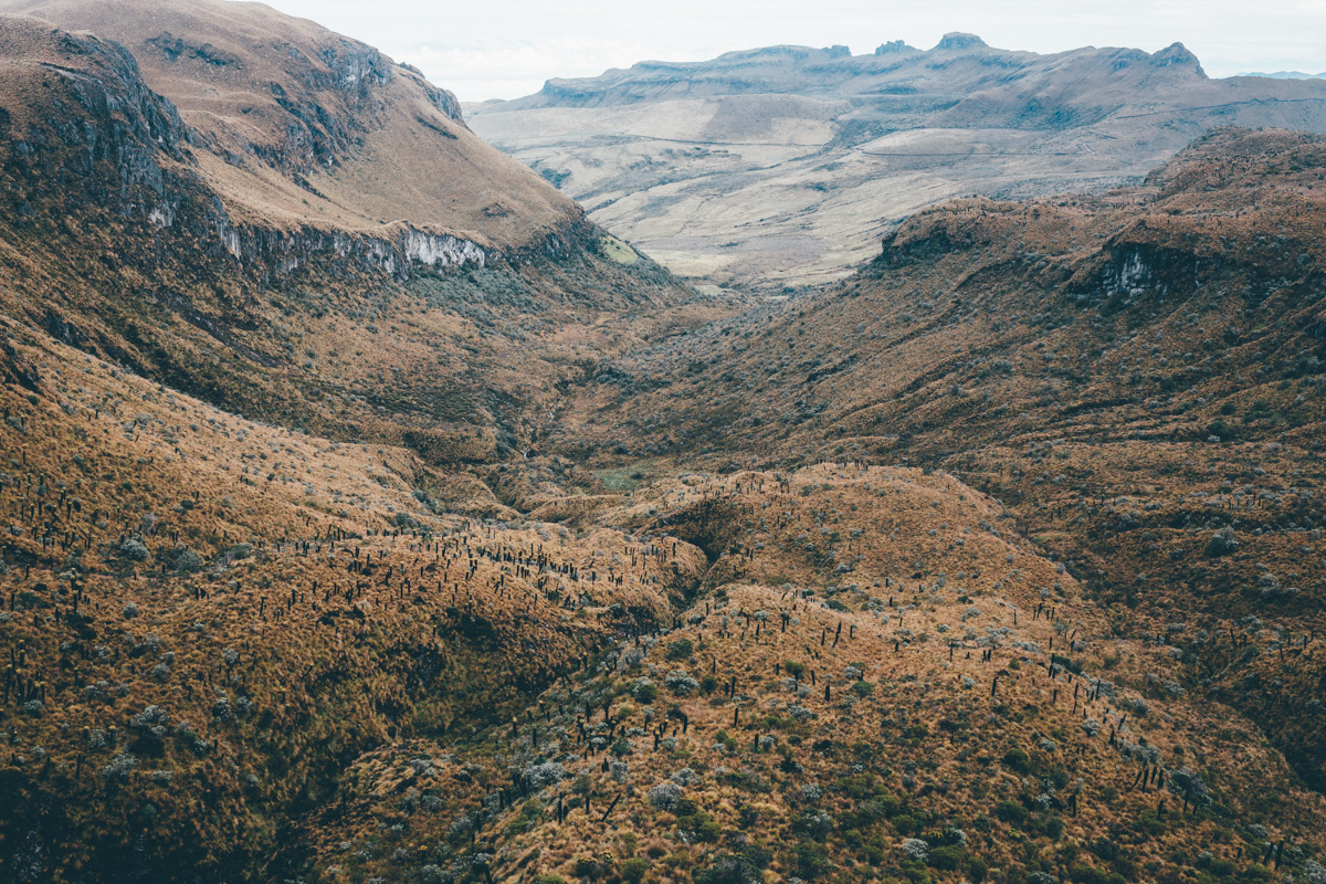
Combining the likes of low-traffic jeep tracks, swathes of rolling páramo, the wonderfully bizarre and beautiful Frailejón, the serene Laguna del Otún, a burly 4700m volcanic traverse, and (eventually) a 2800m whirligig descent through cloudforest, it’s as stunning a bikepack as I can hope for. Much of the route lies above 4000m. It tops out with a 4750m pass – perhaps the highest in the country – that skirts round the 5,321m-high Nevado del Ruiz, the largest of the five volcanic craters that dominate the skyline of Caldice province.
There’s a caveat though. Unfortunately, the pass that neatly connects the two sides of the Parque National Natural Los Nevados (to give it its full title) is officially closed at the moment, due to unstable seismic activity… This means a stealth/night mission/fence hop is required to complete a crucial segment of the loop, and avoid plummeting back down to a lowly 1900m in altitude along the way. The status of the road may change in the future. If and when it does, this is a bikepack that’s not to be missed.
Notes:
Read about Paul’s thwarted attempts to hike-a-bike to Salento, and his clandestine nocturnal adventures, here.
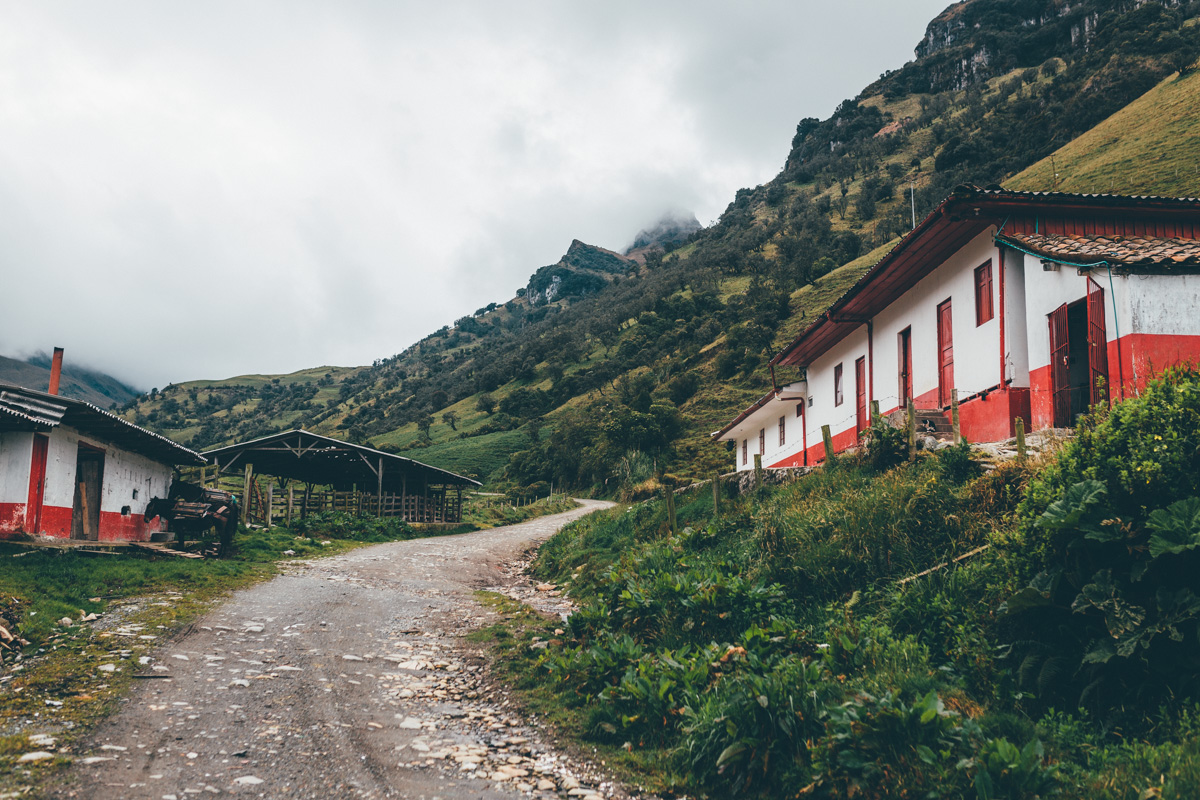
The park has had a recent revamp. Entry has been reduced to 25,000 pesos ($10) for foreigners. Our tickets were checked regularly by the park’s friendly rangers – at Potosí (3850m), at Laguna del Otún, and Cabanas de Brisas (4050m), the main entry to the park. Camping at the designated sites is free, and there’s basic accommodation at Potosí for 7,000 pesos per person.
We exited the park via the dirt road signposted to the hot springs at Termalez de Ruiz, dropping down to La Enea. This avoids taking the main paved route. It’s around 35km from the ranger station at Cabañas de Brisas to Manizales, with nary a climb.
The Legal Route:
The ride to Laguna del Otún is an out and back along a 12km rocky road; it’s almost completely rideable with a bikepacking setup and some determination. Just the last two kilometres of trail are too awkward to pedal; it’s best to stash your bike in the paramo and hike in to the lake on foot. Once there, we wandered up amongst the Frailejón to a nearby, smaller lake. With more time and better weather, the day hike to Santa Isabel’s glacier is definitely recommended – which apparently takes 7 hours there and back.
In fact, given the closure of the road around Nevado del Ruiz (for good reason), I’d recommend simply making a three day dirt road loop from Villa Maria to Laguna del Otún (exiting via Santa Rosa), with an extra day put aside for hiking to the glacier.
Alternatively, you could use the park as a means to link Manizales with Murillo – and onto Ibague (see wikiloc for dirt road ideas), detouring up to the Nevado del Ruiz volcano as a side trip, via Cabanas de Brisas. You’re allowed to ride to the base of the pass.
The Cycle/Hike (Thunderforest on Gaia) layer of OSM maps shows all the roads for the route.
If you would like to keep up with where I am between tardy blog entries, I keep my While Out Riding Facebook page more regularly updated – along with posting extra photos and gear ponderings. You can find it here. Occasionally, I post pictures on my Instagram feed. And if you haven’t overdosed by then, I’ve also started a While Out Riding Tumblr edition, focusing on images.
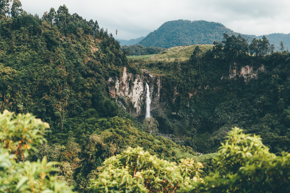
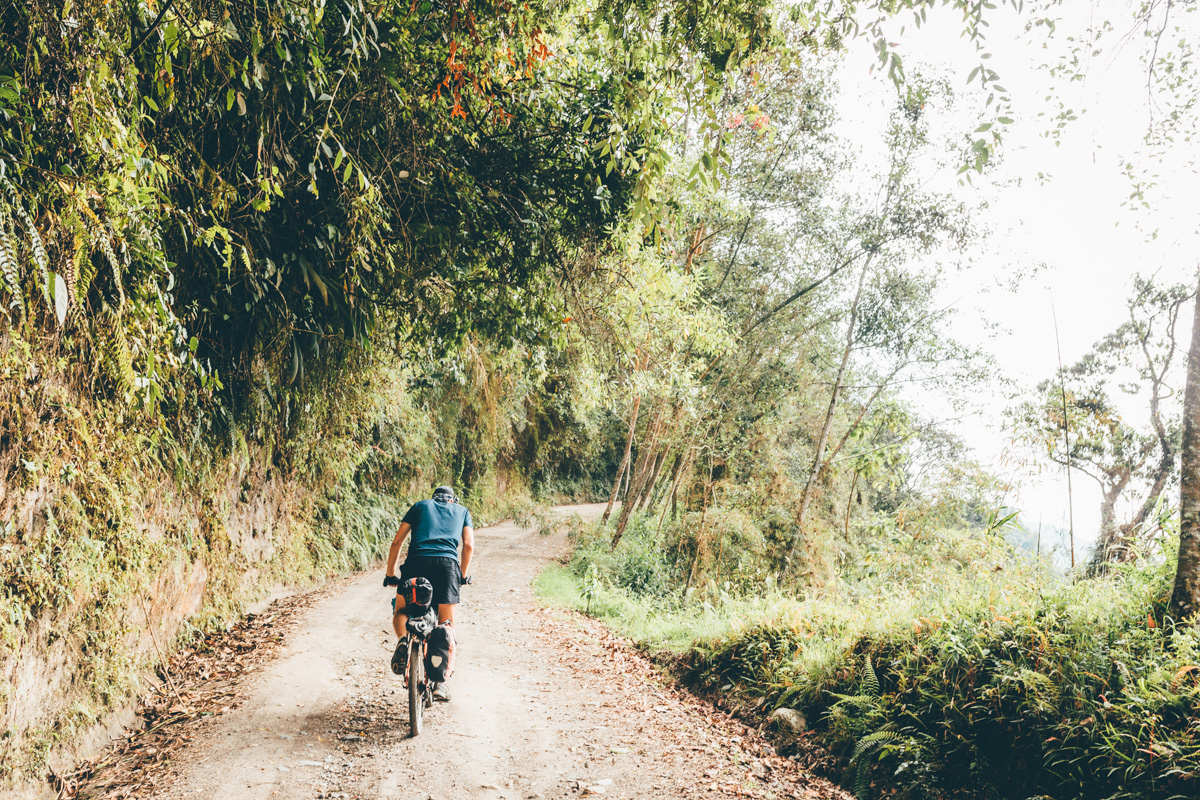
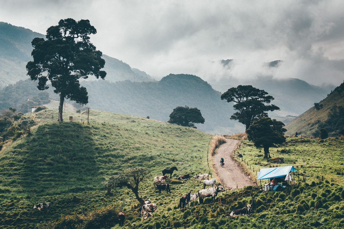
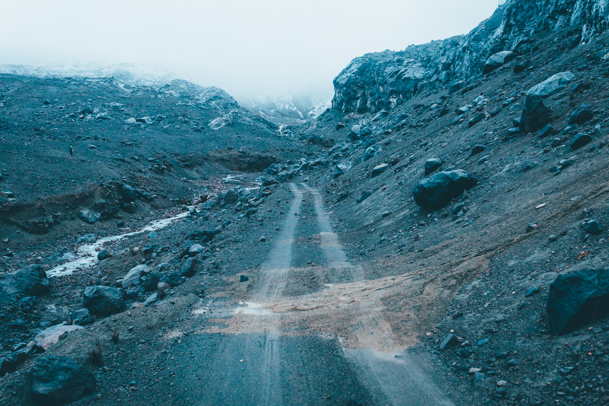
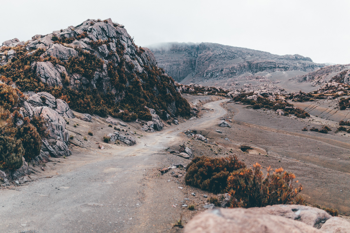
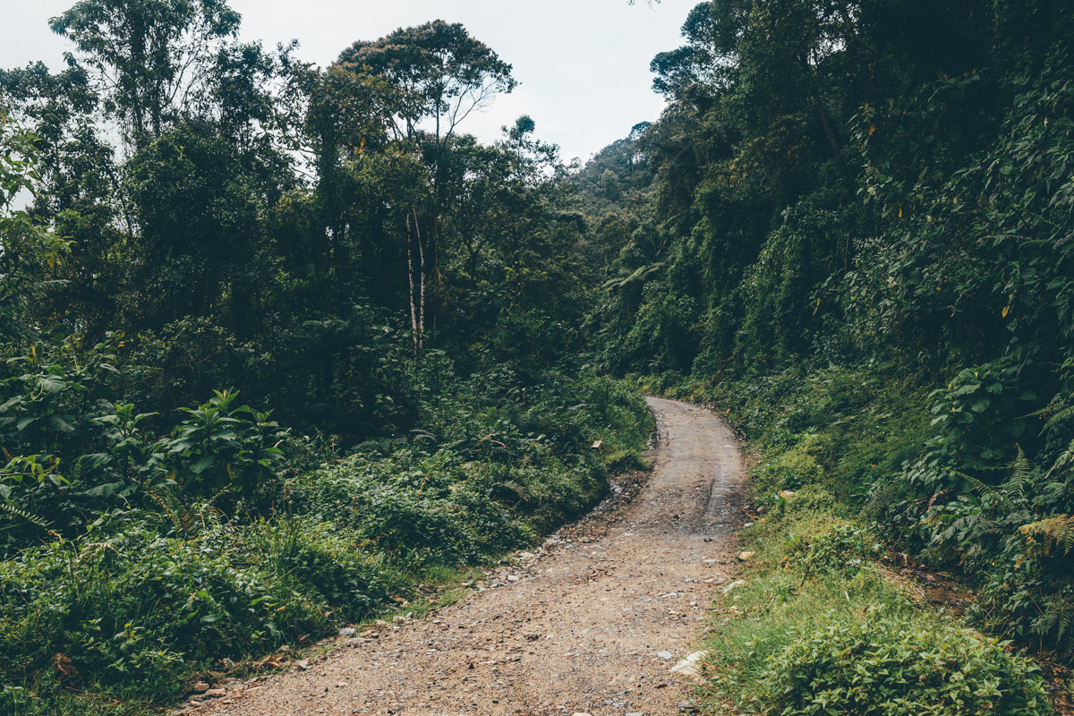
It’s 2pm by the time we leave Villa Maria, following a dirt road that climbs ever upwards towards the park, ushering us from 1900m to over 4000m. Punctuated by a series of waterfalls and dairy farms, it makes for perfect backcountry touring.
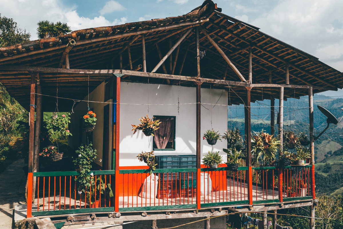
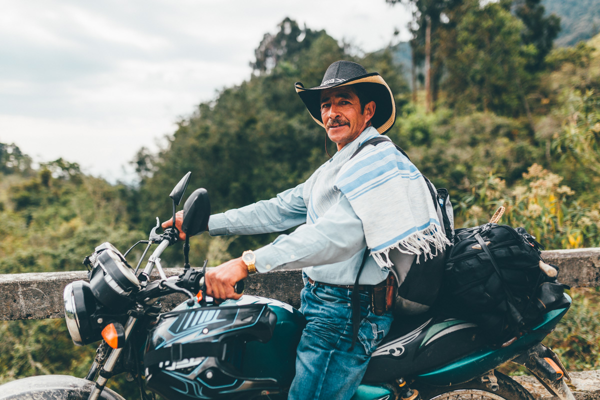
Without exception, Colombians we meet are friendly and engaging.
Weather in the cordillera is unsettled at the best of times. This is the rainy season, and with it comes the promise of additional afternoon downpours.
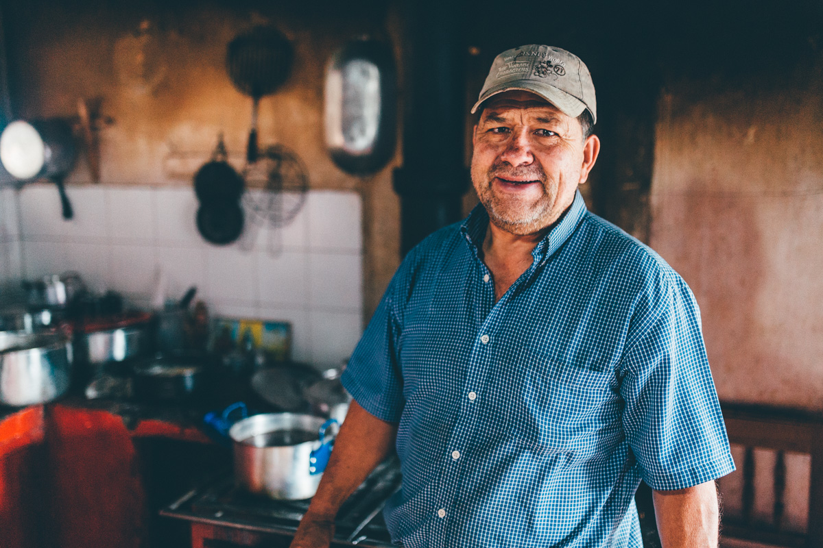
As dusk falls, we find ourselves pedalling past the dairy farm of Los Alpes, some 30km from Villa Maria. Jovial Omar, the farm manager, invites us to camp in the yard…
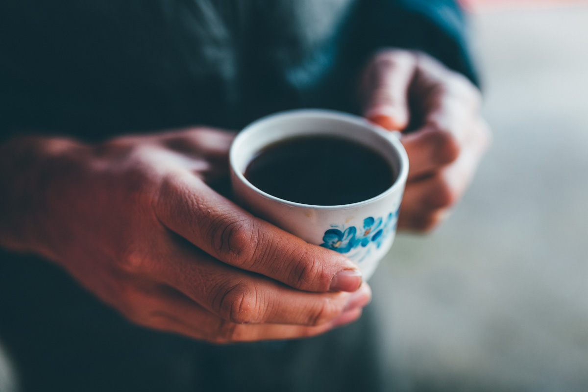
… before pressing cups of coffee into our hands, infused with agua de panela.
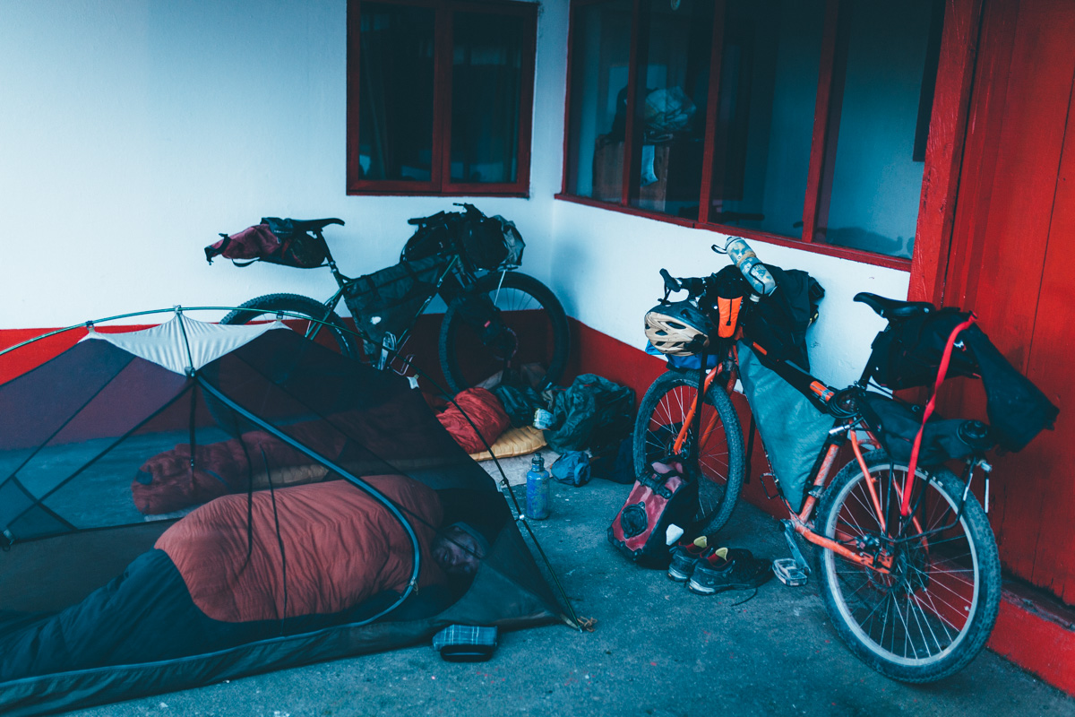
Our digs for the night, complete with dogs, cats, cockerels, a Krampus and a Troll. Nick cocoons himself in his MSR Huba. Seeing as I’m only carrying my 6 Moon Designs Deschutes tarp, I opt to roll out my sleeping mat and fend off a fleet of giant, egg-sized flying beetles that hover around.
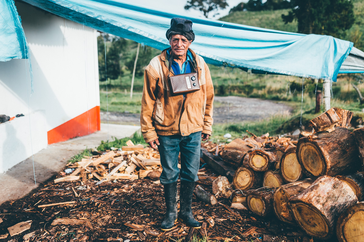
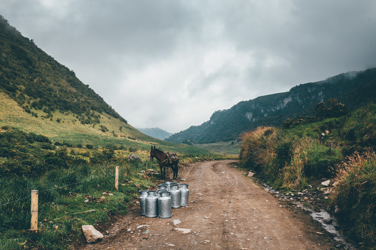
In the middle of the night, the cow milkers also get to work. Milking is done by hand at 1am and 1pm. With each worker assigned twenty cows, it takes several hours per shift. Containers of milk are then loaded onto horses and hauled up to the farm. It’s a hard life, for sure…
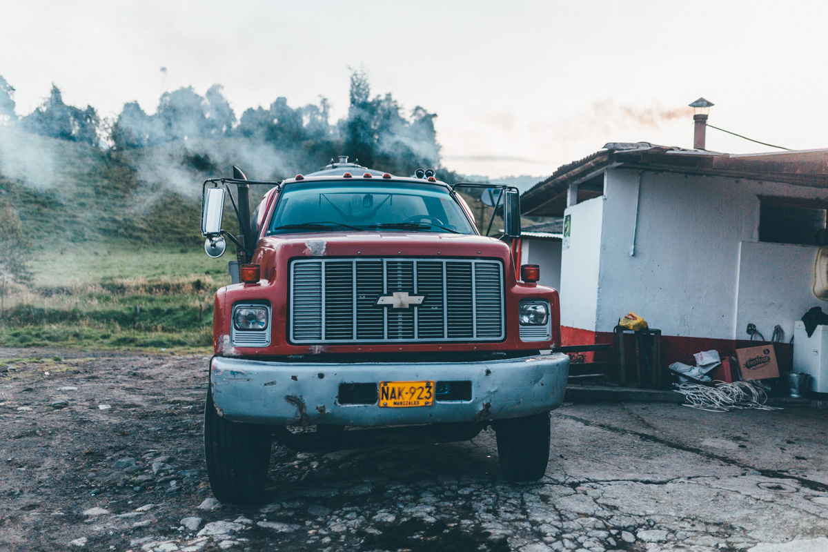
Come dawn, the fruits of their nocturnal labour is collected by a Chevrolet milk truck rumbles up and down these dirt roads between farms.
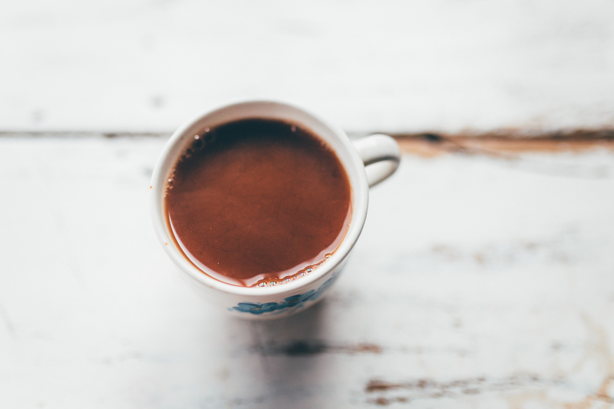
Or, it’s made into delicious hot chocolate that Omar ladles out to any takers.
After filling our bellies with dairy products, we take to our bikes to continue the climb, passing other milking stations along the way. No mechanisation around here…
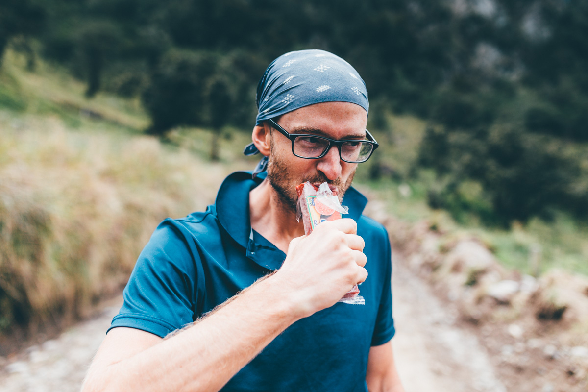
Forget Cliff Bars. In Colombia, energy comes courtesy of bocadillos, sugar-laced guayaba bricks perfect for lengthy climbs.
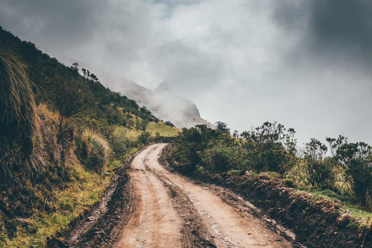
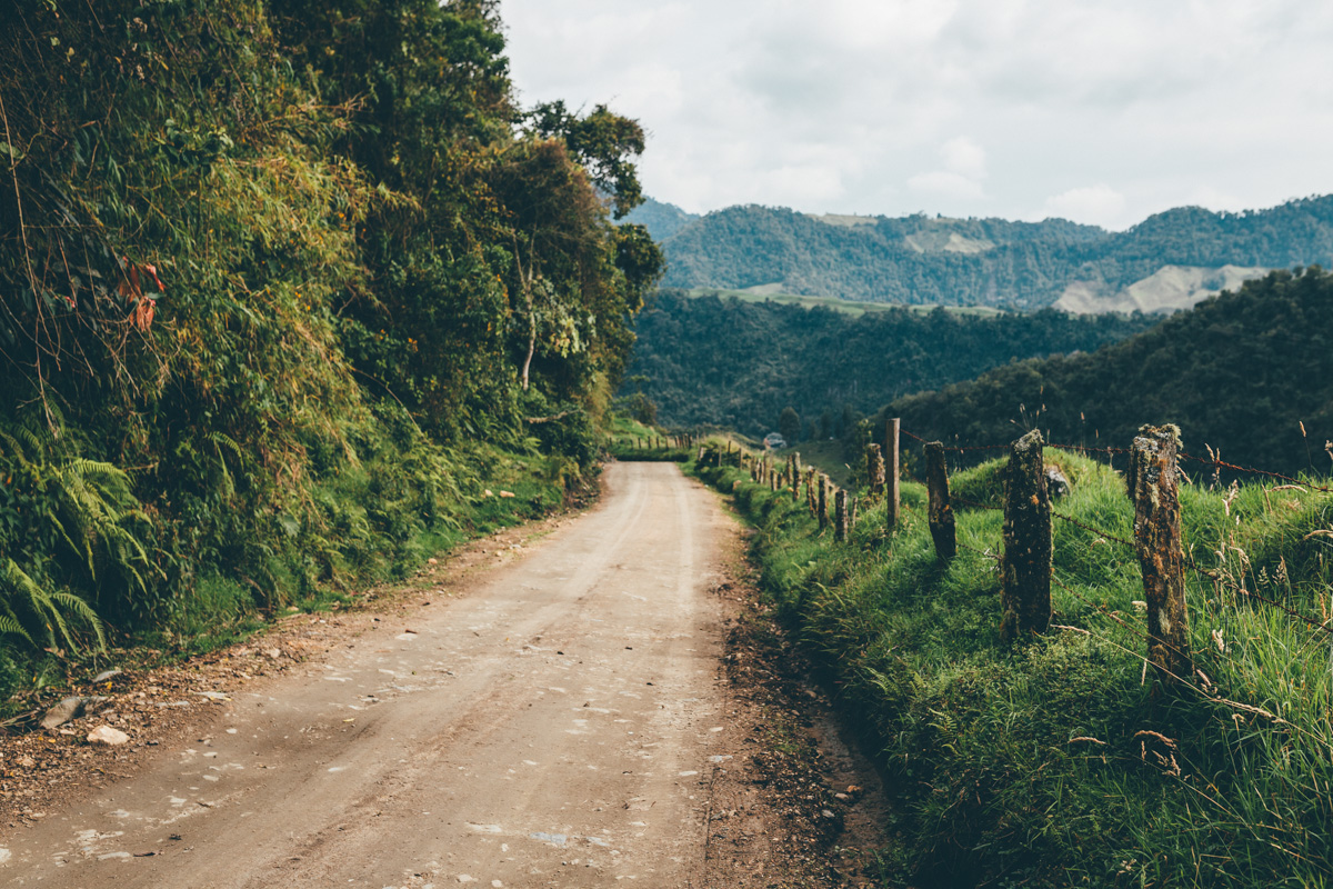
Onwards we ride, the dirt road steeper in places as we close in on the national park.
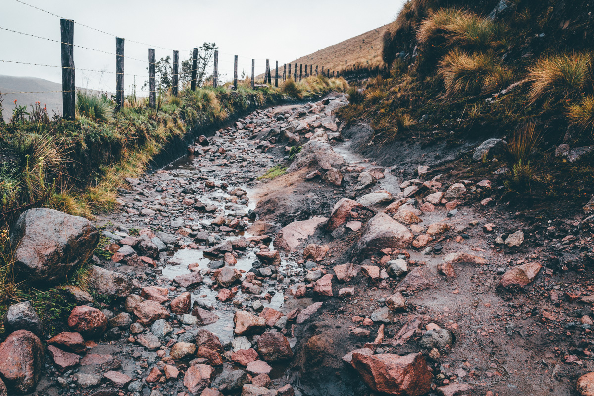
Reaching the juntion of Potosi, we turn off towards Laguna Otun, where conditions take a turn for the worse.
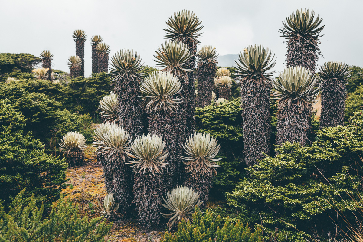
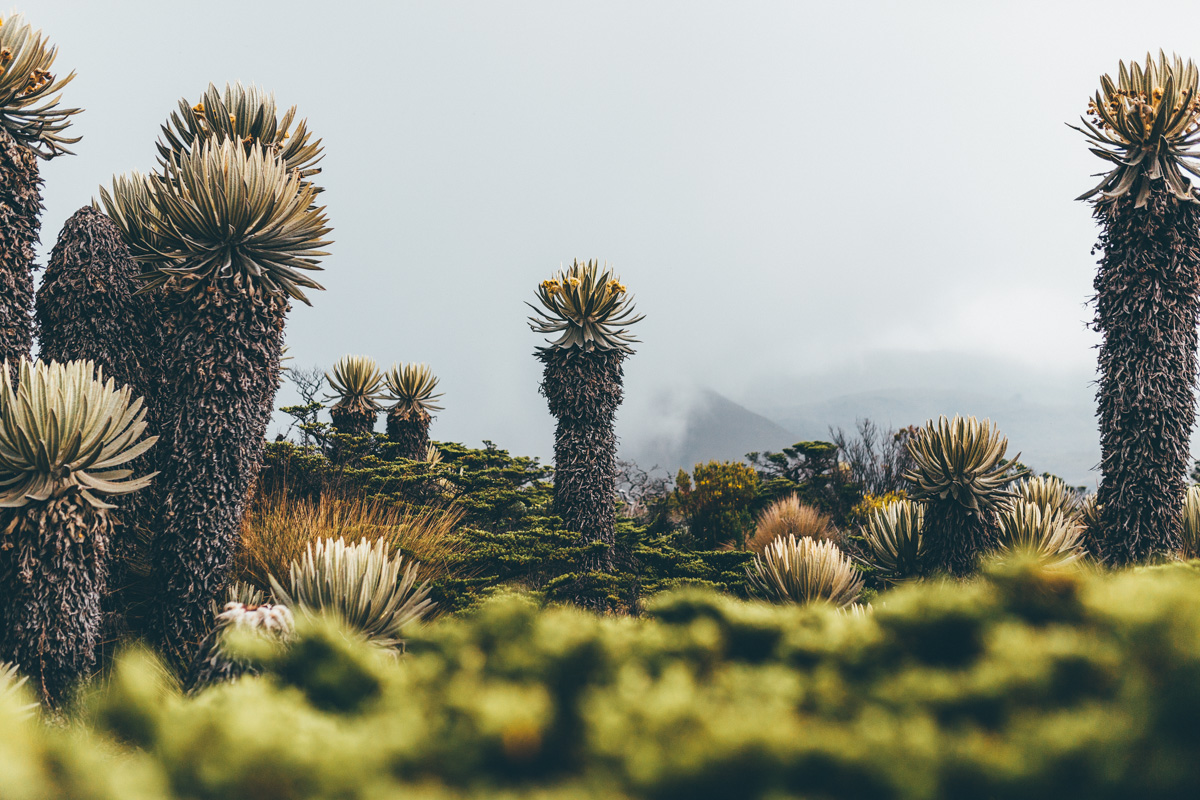
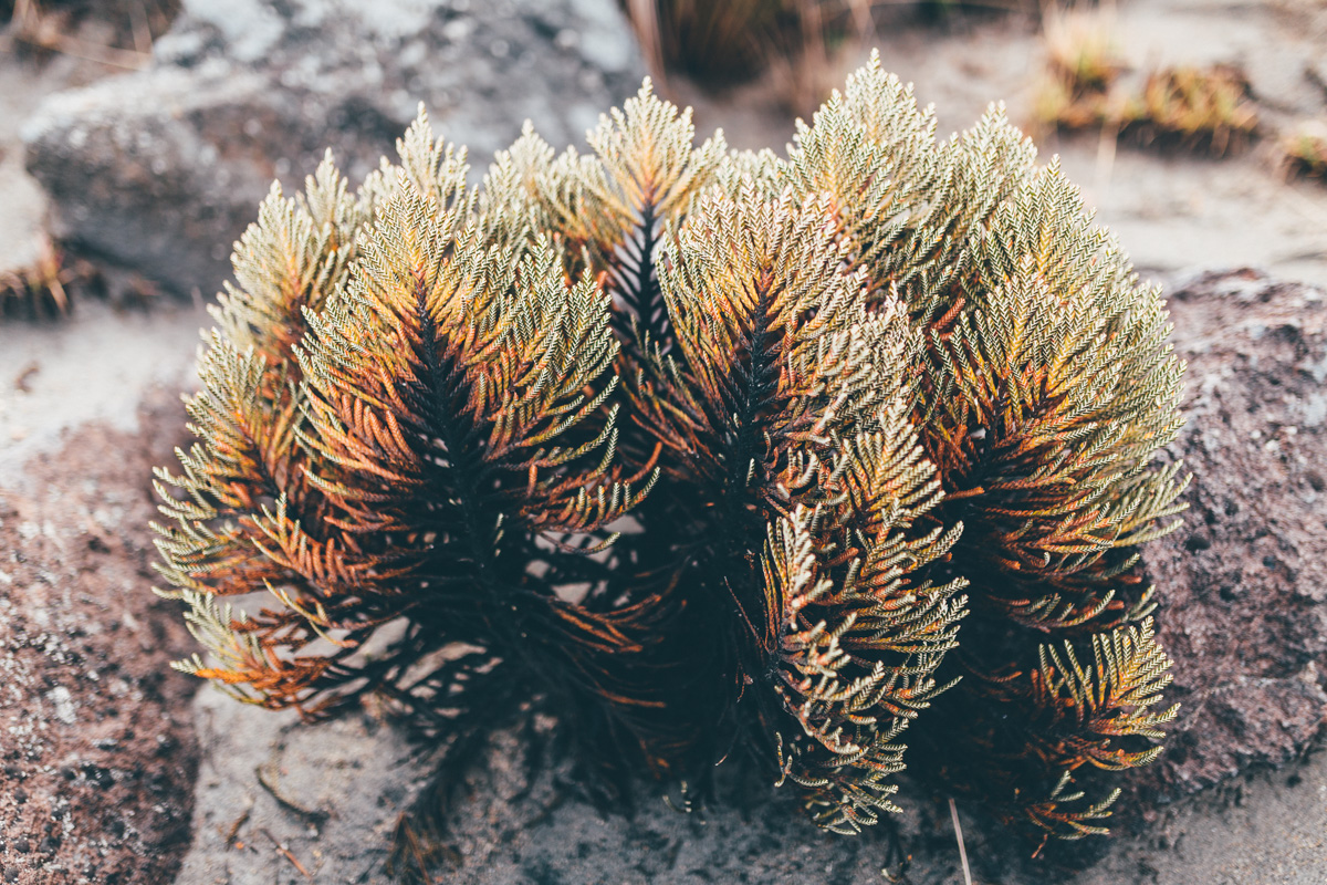
Soon though, we’re back on a stony track, winding our way between clusters of frailejón, the high altitude plants that populate the moorland – just like the ones I saw in Ecuador.
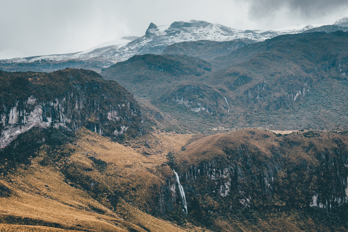
Glimpses of Santa Isabel, one of the five volcanoes in the region.
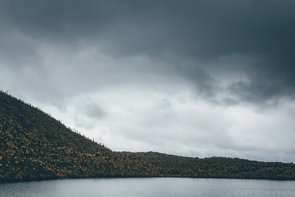
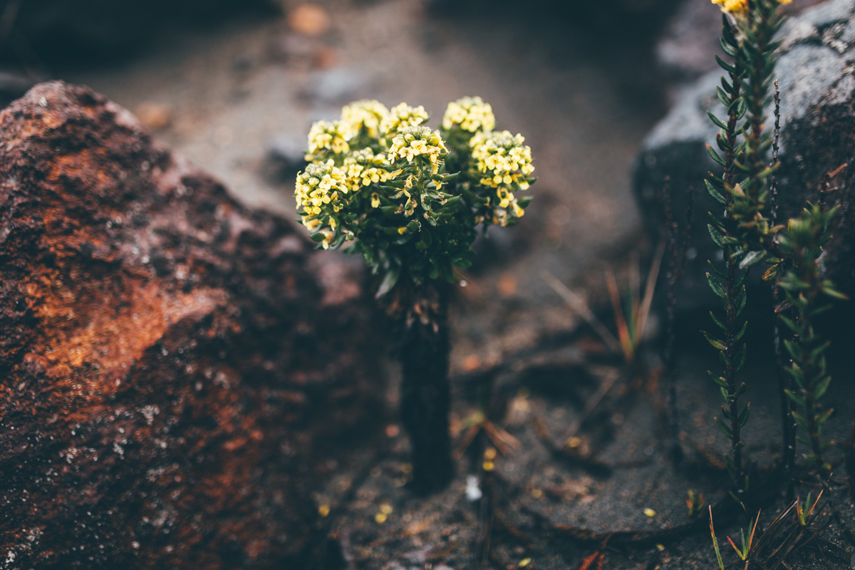
A misty, damp environment at the best of times, our hike up above Laguna Otun is a boggy, rainy affair. But it’s beautiful and otherworldly nonetheless. Without doubt, this area would make for some incredible multi-day hikes. Bring your wellies!
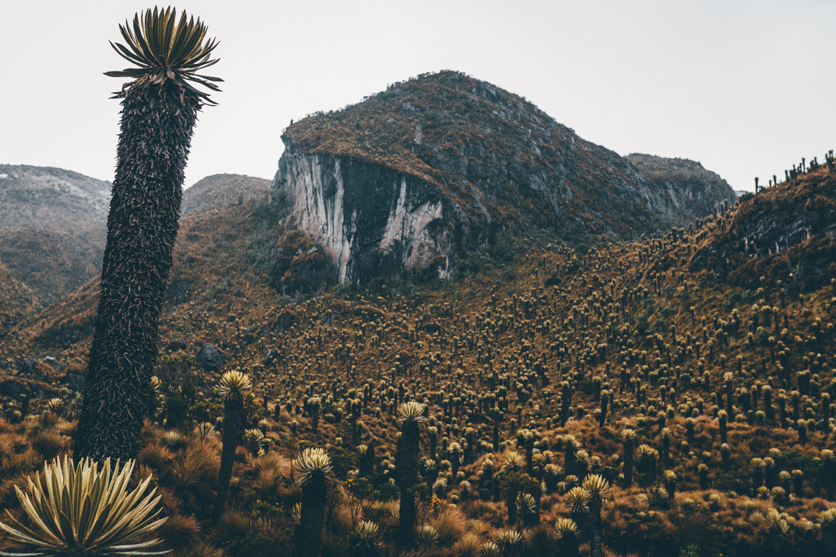
Frailejon grow just a centimetre a year. Several specimens we see tower over 5m high, making them some 500 years old. Others in the park are said to reach twice that in height – a millennium in age.
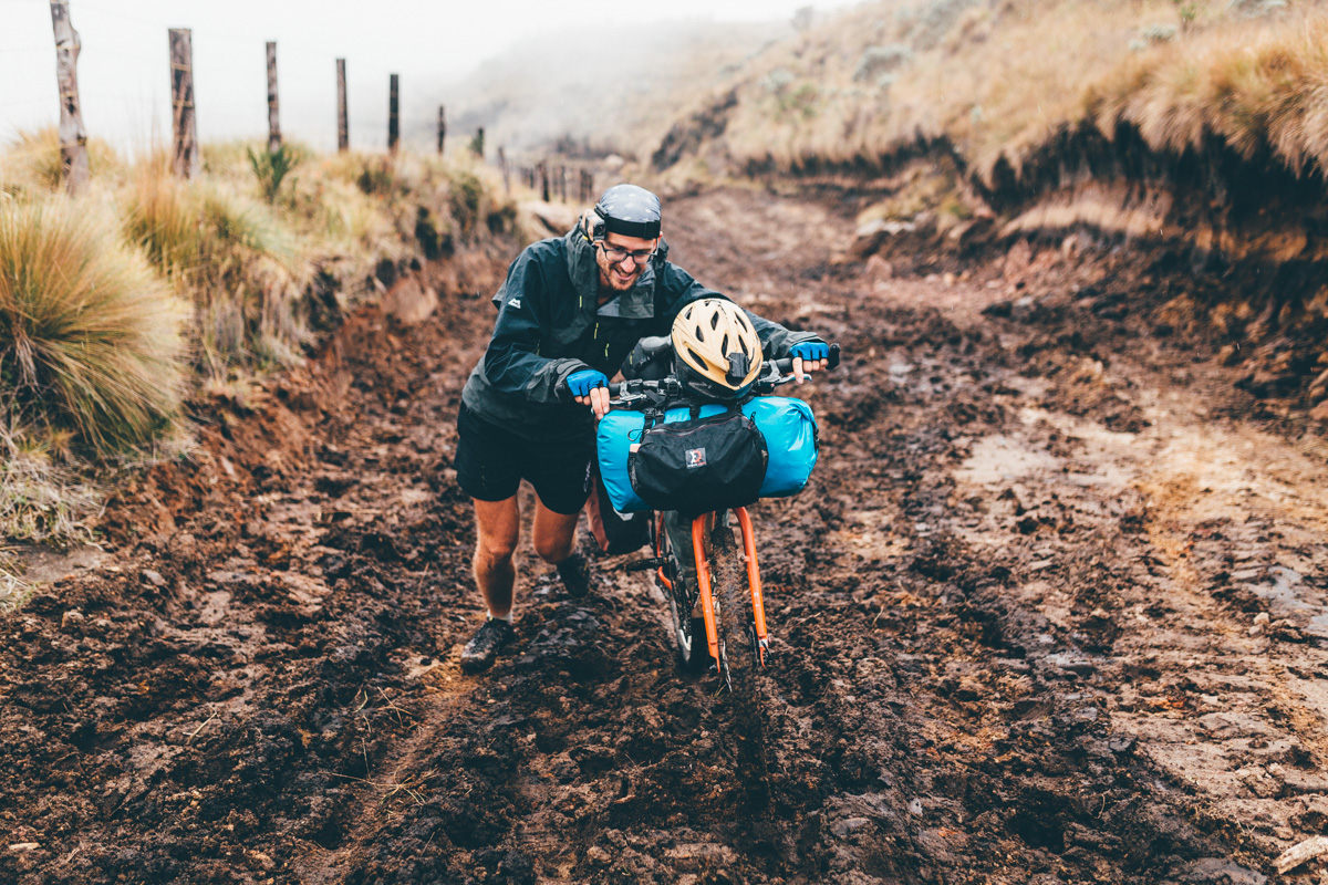
From Laguna del Otun, we backtrack to Potosi. The Krampus’ 29+ meaty, low pressure tyres transform rocky terrain into challenging but eminently manageable riding, with a lightweight bikepacking setup at least. Fully loaded behemoths would seriously struggle, especially here at 4000m.
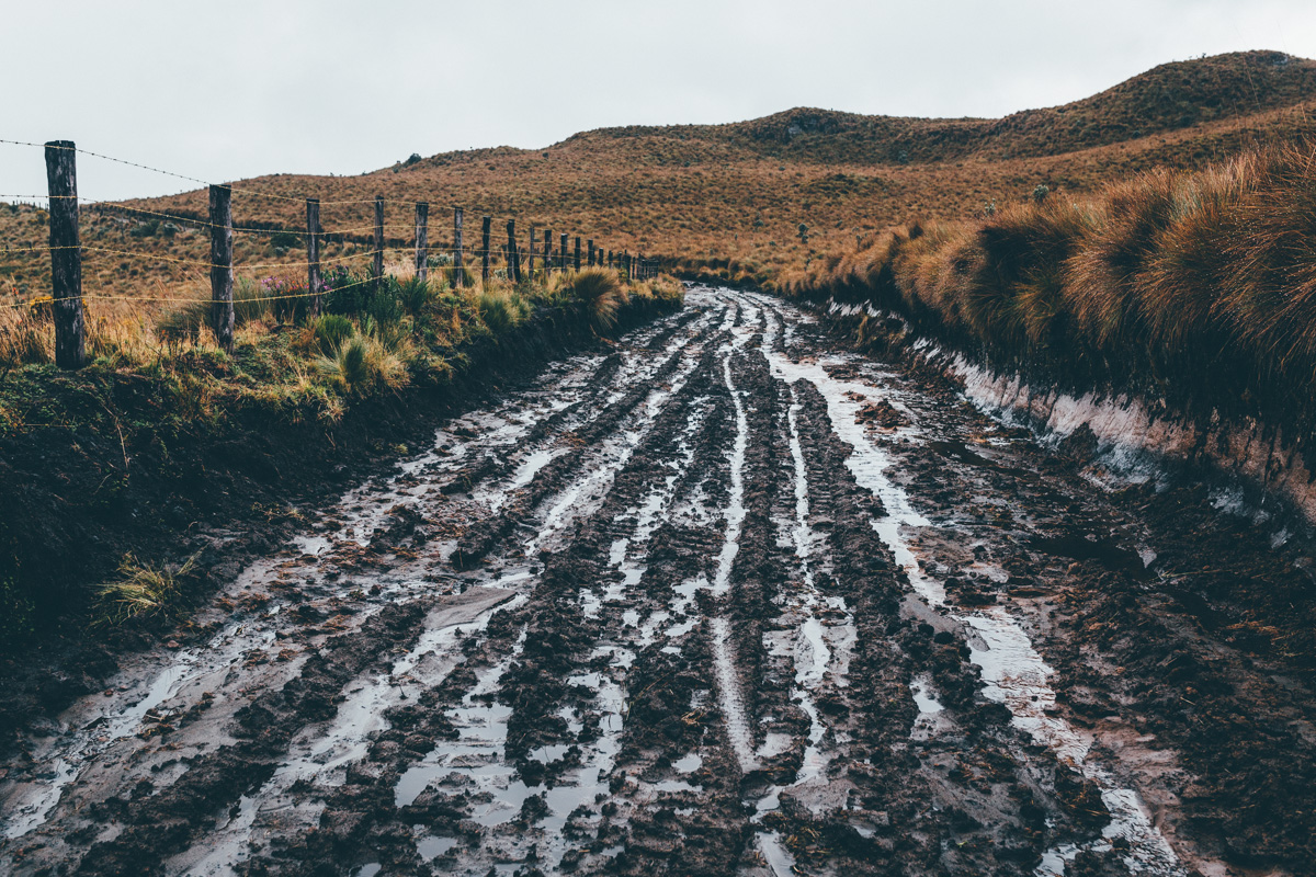
But after a morning of heavy rainfall, even a midfat struggles in gloop like this.
That night we creep round a closed gate under the cover of darkness, and camp in a scruff of paramo, priming ourselves for a 3am assault on the volcanic pass ahead.
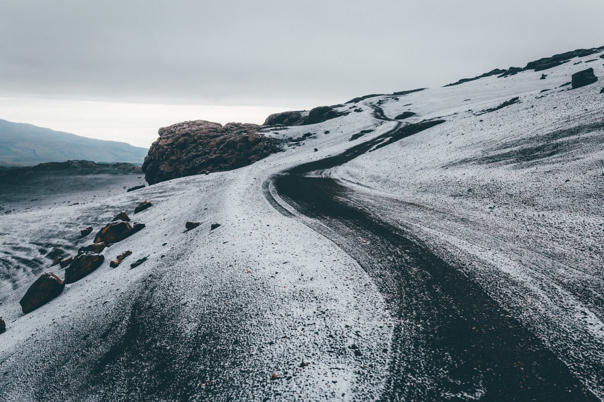
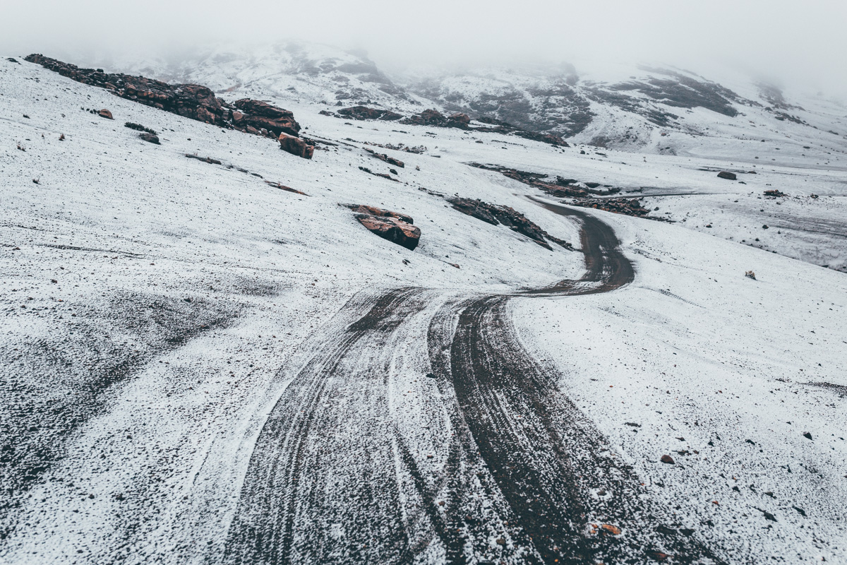

The last few kilometres are slow going, as tyres scrunch over a bed of snow, sand and mud.
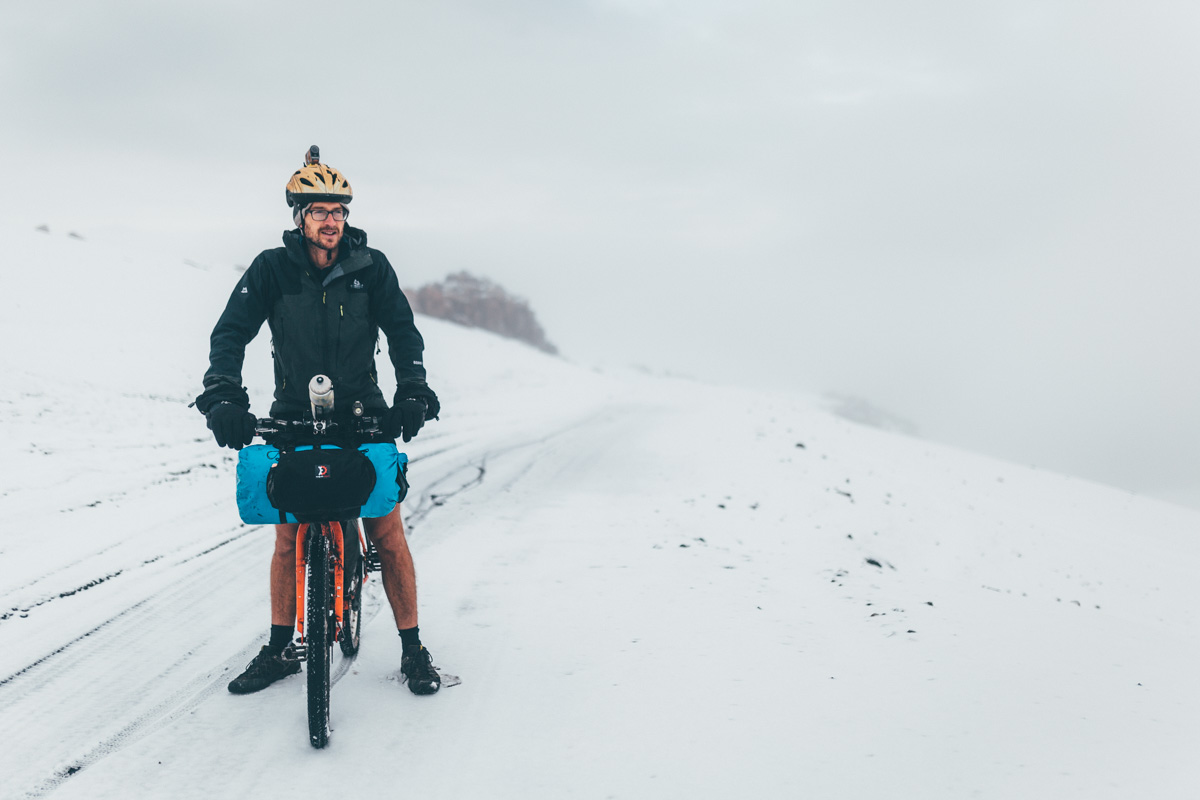
Almost at the top. Nick, nursing a sore belly, a cough and a cold. But still in short shorts…
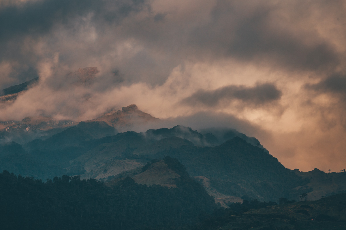
We crest the pass in the early hours, rising above a duvet of cloudcover from which surrounding volcanos peep.
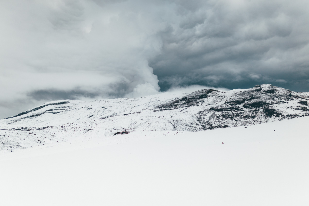
Bubble, bubble, toil and trouble…
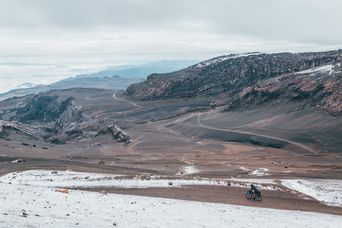
Then comes the descent, on a wonderfully loamy track that unravels its way down a broad volcanic valley. A rope across the road signals the end of the closed area.
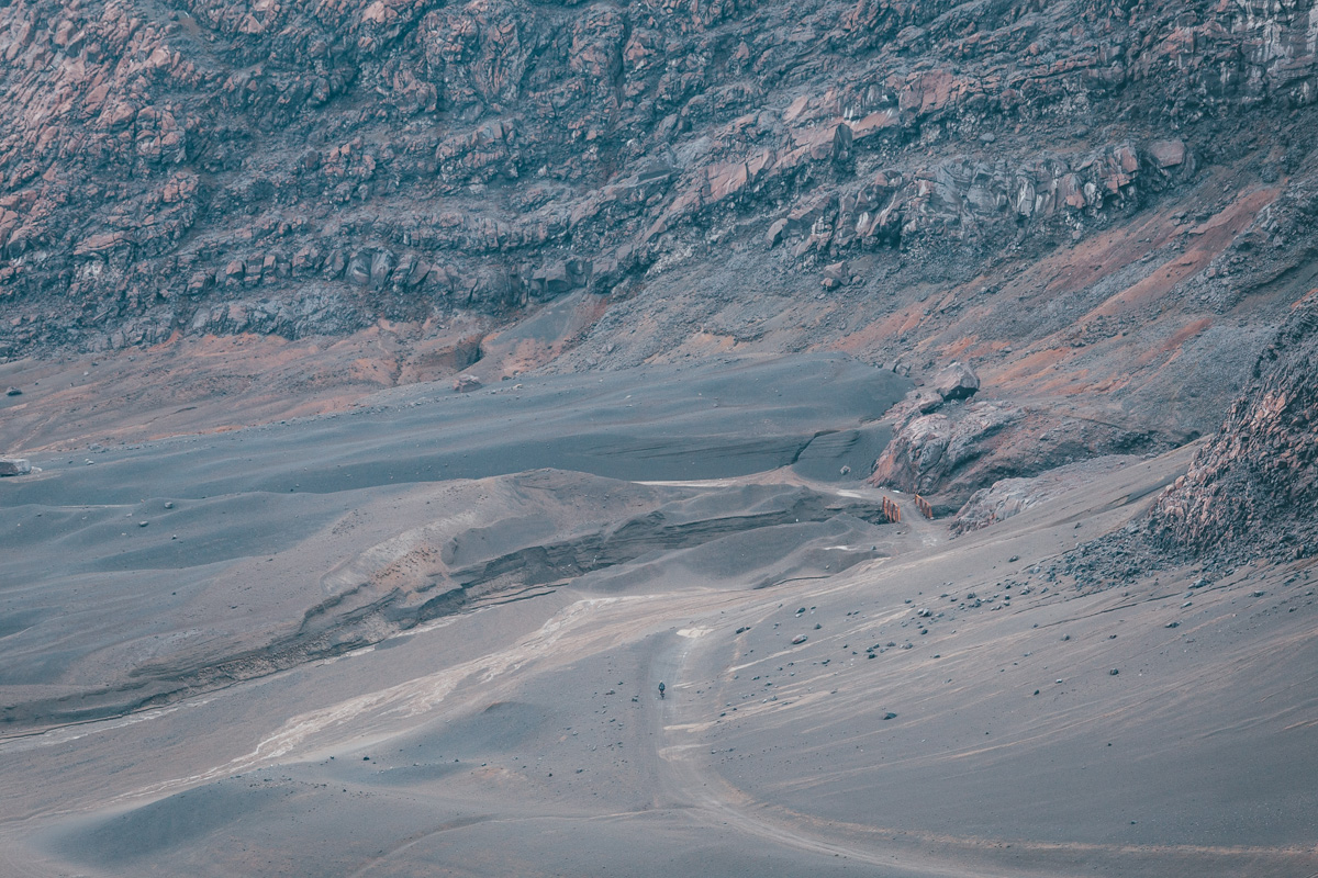
4400m. Hardy, fan-like plants of the ‘super-paramo’.

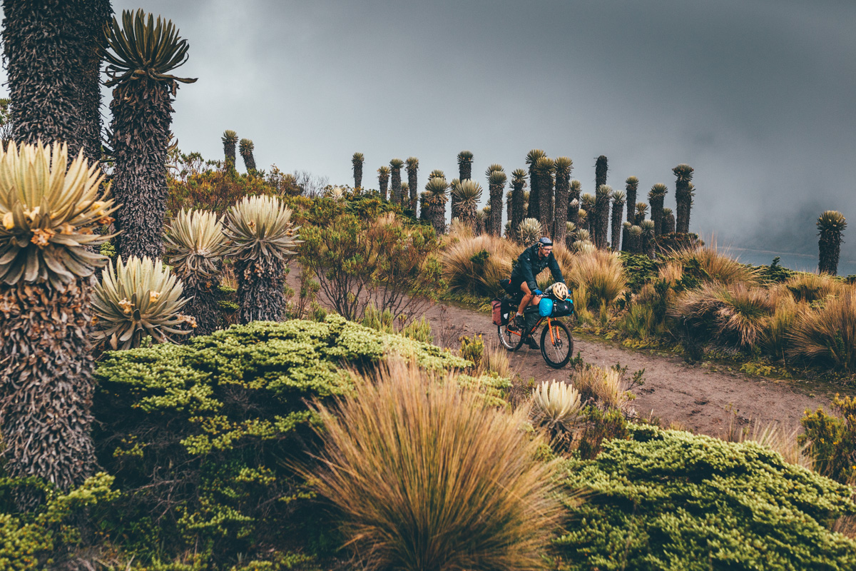
Below 4300m, the valley is populated once more with an army of frailejon, as if awaiting our arrival. At the entry to the park – Cabanas de Las Brisas – the rangers are waiting for us too. We’re politely informed about the closure of the road, so we know ‘for next time.’
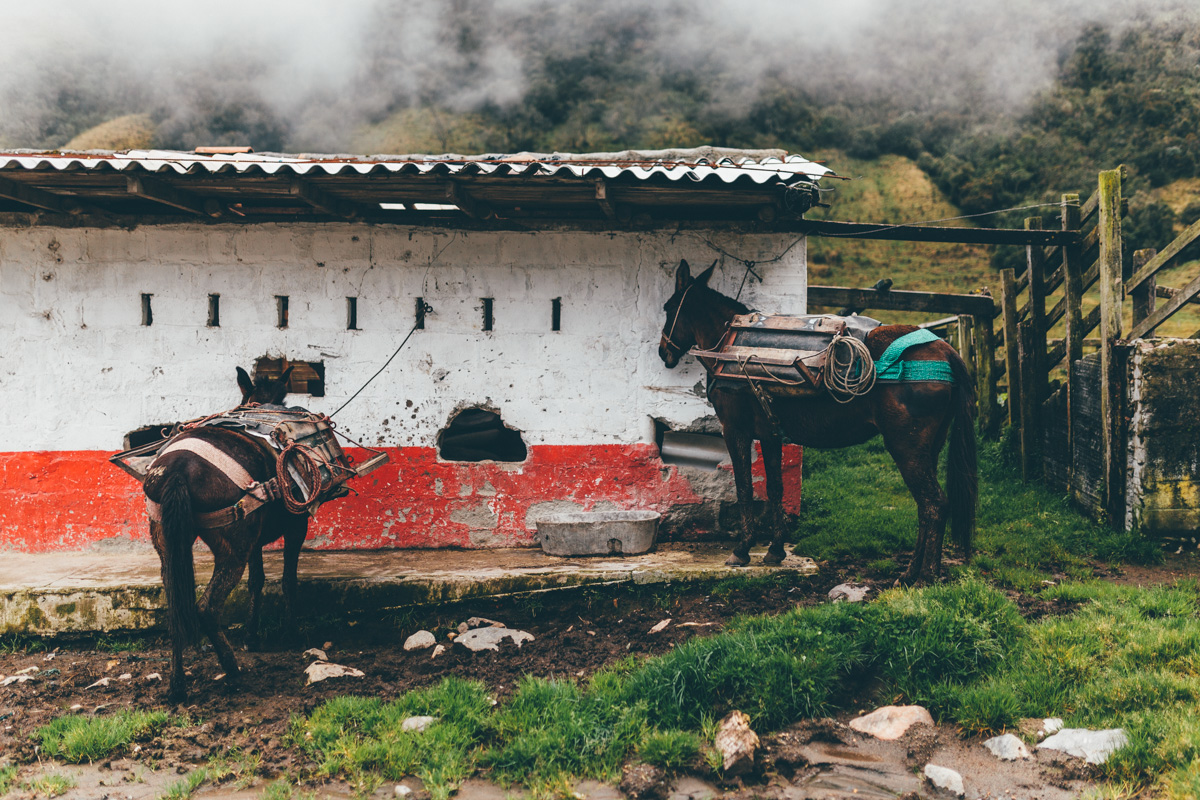
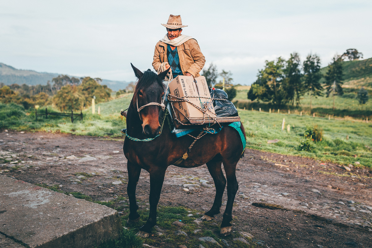
Too soon, we’ve left this mountain moorland and are back once more into the farm belt. Horses and mules are parked up in readiness for milk-toting duties.
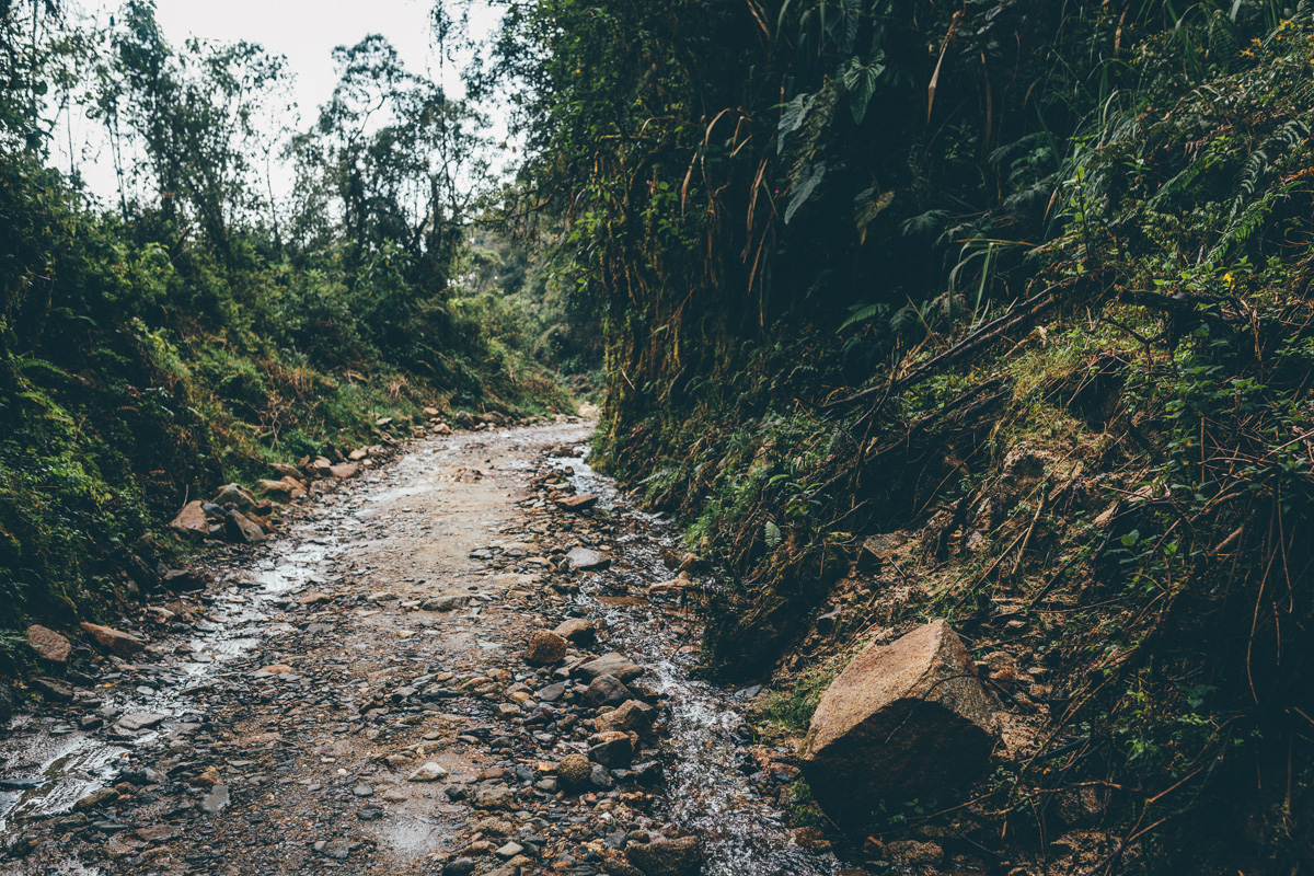
Down, down, down, into the jungly depths of the cloudforest we go, finally emerging back in balmy Manizales.
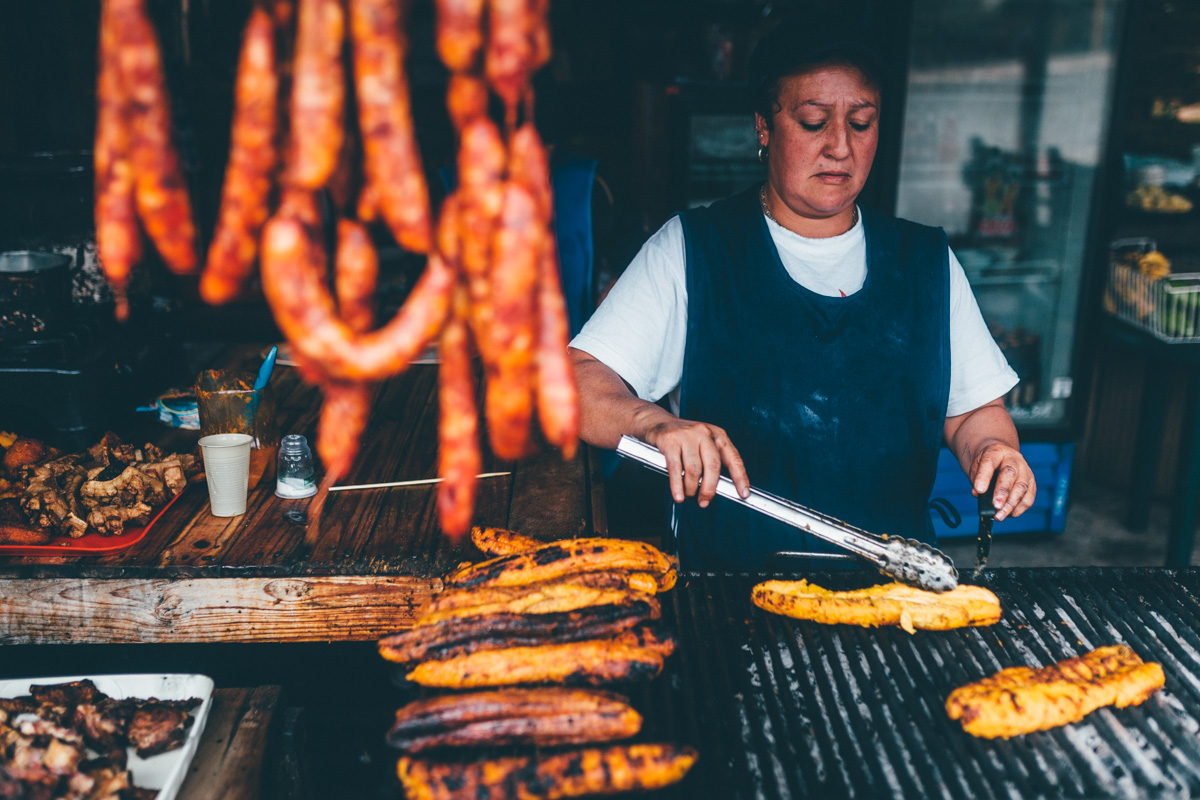
A few kilometres before we’ve returned to the frenzy of the Manizalan highways, we stop for traditional sausages…
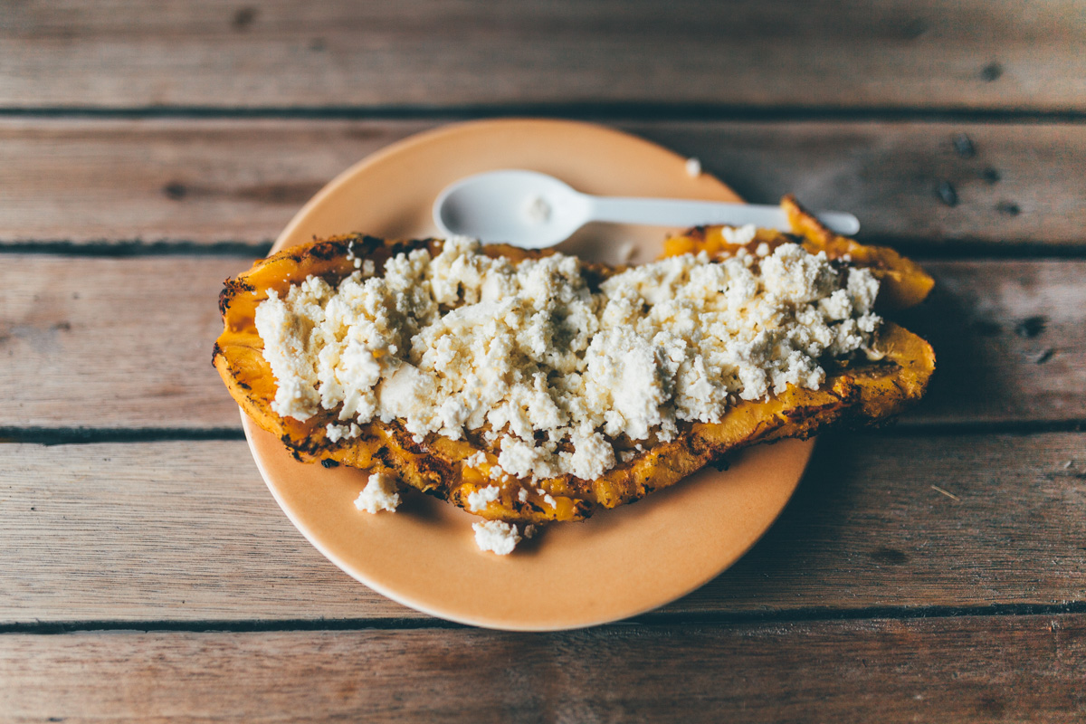
… and roasted plantanes smothered in cheese.
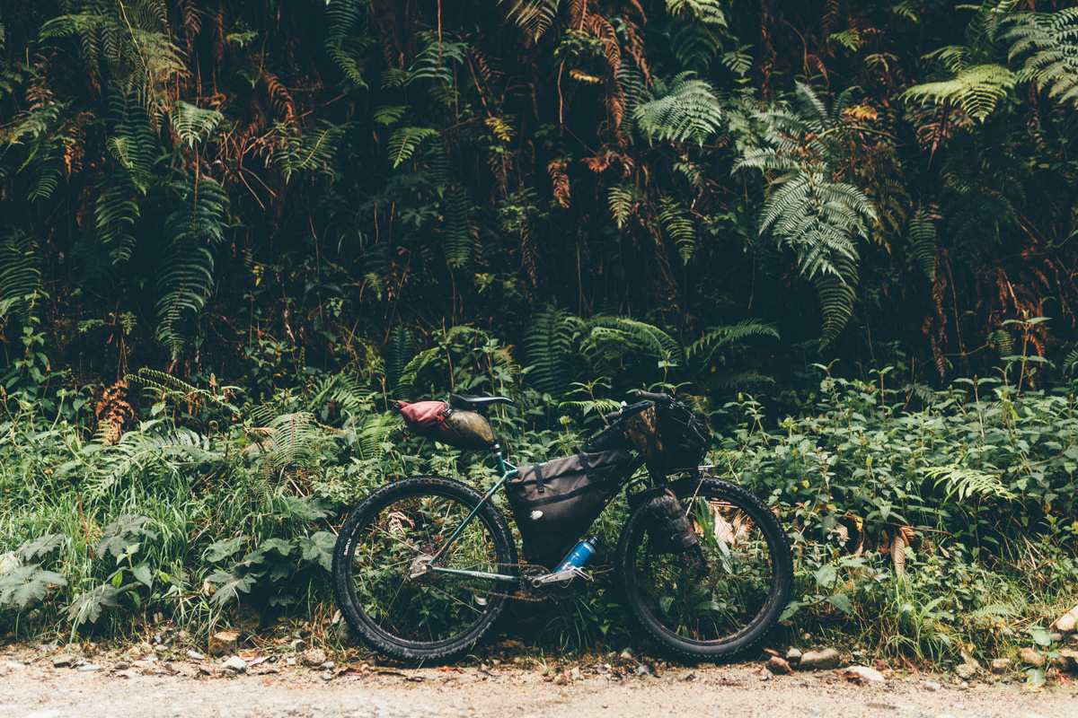
So. Much. Fun. The Krampus is winning over my heart for bikepacking. Just as Colombia is winning it over for adventurous, backcountry riding.

Hi Cass,
Great stuff as usual.More inspiration for me.
Could you tell me what size tires was Nick using?I’ve got a Troll too and was wondering what would the minimum width for Bikepacking in South America in general.
Thanks and safe return journey.
Ian
It depends on what you want to ride, and where you want to ride, I guess… I always go with the widest tyre I can, even if it means a penalty on pavement. Nick was running 2in tyres, but he definitely struggled over the rockier terrain – compared to the monster tyres of my Krampus!
I’d look for 2.3/2.4 tyres myself, and a widish rim too. The Troll has got good clearances, so why not make the most of them!
Amazing photography! Big fan. Im cousin with the Dammers. Would’ve love to hang out while you where here with them. All the best. Santiago.
Thanks Santiago! Sorry we didn’t get a chance to meet up. I miss those Dammers!
Astonishing! Great inspiration for me as well 🙂
One question – what camera are you using for photo shooting? I guess it must me light and small in the world of bike-backing, but from other hand pictures look like would been taken with some good DSLR
Cheers!
Yeah… that’s the irony… I travel with a minimal tarp/cookset/sleeping bag, but I lug around a DLSR. It’s a Canon 6D, and it amounts to more combined weight than anything else I have! I expect I’ll move to mirrorless when finances allow.
Thanks. Actually I found the answer on your previous post. I need to follow you more often 🙂
…and don’t change your camera. Your photos are just perfect!
Hey Cass!
So cool you and Nick are riding together! I haven’t yet met him in person but we’ve been in correspondence since before I left Prudhoe Bay. I’m currently in Durango, getting ready to find bikepacking routes South through Zacatecas and Guanajuato to end up climbing as many of the crazy roads to those volcanoes outside DF as I can… We’ll see how it goes. I might follow your route from here to Zacatecas… Let me know if you think it’s a route I shouldn’t attempt alone…
Anyway, a quick note: I think the Troll can fit up to a 2.75″ tire as I’ve seen some people talking about putting Dirt Wizards (if they ever become publicly available!) on Trolls.
Can’t wait to get down to South America to see all those amazing routes… for now finding some pretty awesome possibilities through Southern Mexico. Perhaps we’ll get to share a bit of trail someday as well!
Take care,
Scott
Hey Scott,
Sounds like you have some great routes up your sleeve. Nice!
I seem to remember the Durango-Zacatecas route being pretty cool. Love Zacatecas too – loads of cool nearby trails. I hooked up with some local mtb’ers when I was there and went on some fun rides.
Yes, the Troll takes 2.75s DWs. They’re available, as far as I know. It’s the 29+ flavour that’s in short supply. But… it’s depends what kind of rims you’re running, and whether you have a Rohloff or derailleurs, as to the likes of chain rub. I believe you can only run them with Rabbit Holes if you have an IGH.
All the best for the delights of Central America ahead,
Cass
Awesome… can’t wait to ride Colombia.
Have a great reencounter with Sage and Nancy (flying today! 20th?)
Hug
M&M&K
Gorgeous, as always Cass! I guess I can add Colombia to the list. Smooth travels back north.
Pingback: Cass Gilbert durch den Parque Los Nevados in Kolumbien | de velo
Lovely! Is that a new VSCO .. ? 😉
Ha! No… same old settings (-;
Great pictures as always. Any thoughts on getting a RH wheelset for your Pugs? I would like a Krampus as well, but I think just another wheelset for my Pugs would do just as fine.
A couple of friends have tried it, and the feedback has been largely positive. But as I’m lucky enough to own both a Pugs and a Krampus, it’s not something I’ve really looked into.
Pingback: Colombia, I love you! | Nick's Bike Tour
Hi Cass, I was directed to your blog by Nick Gault whom I met in Feb 2013 when he stopped in Punta Perula Mexico south of Puerto Vallarta. After a lifetime teaching career and traveling to 60 countries, at 60 years old I bought an RV and have been staying in small communities in Mexico the past 8 years in order to learn the culture and meet the locals. I, of course am a “Snowbird” from Saskatchewan who escapes the brutal winters. Though I am not a cyclist ,I learned a lot from reading your informative blog and marveled at your resolve to conquer those horrendously muddy roads and to keep your spirits up in inclement weather! Your photos are National Geographic worthy and I went “AH’ in awe at the one coming over the crest and the one “no mechanization here”. The latter made me wish to be there on that bicycle… I wish continued health and safety as you explore the world…..Adele
Hi Adele,
Sorry for the delay in writing! Thank you kindly for the comments, and all the best with your ongoing explorations of Mexico. What an incredible country! I loved it all, though Chiapas certainly stands out. I always seem to be drawn to mountains…
All the best,
Cass.
Pingback: The Prohibited Mountain Pass – Los Nevados | Nick's Bike Tour
Thanks for the comment and kind words, Adele.
I can imagine there’s a lifetime of exploration to be done in Mexico, whatever your form of chose transport may be. In the 6 months I was there, I barely scratched the surface, but loved every minute of it.
Enjoy that delicious Mexican fare for me! All the best,
Cass.
Hi Cass. I’m one of the Dammers cousin – Carina. I think Mathias wrote you about me? I’m writting because we are planing a bike trip in colmbia. We found some cheap airline tickets so we are flying to Cali and from there bus to Armenia-Eje Cafetero. The idea is to bike around Eje cafetero and Parque los Nevados for about a week.
I checked your blog (loved it!!)…and your route in Parque los nevados sounds great. The difference is that we’ll be starting from the southern part of the park, maybe from Salento. I read in your blog (or Nicks) that from Laguna del Otun there are no bike trails going south…do you know if there is a nice way (back-road/trail), that connects Salento to Laguna del Otun?
Or what trails or places do you recommend biking and visiting?!
Gracias por la ayuda!!
Hope I get to ride with you guys if you are evre back in Ecuador!! 😉
Hey Carina,
Matthias just emailed me. Unfortunately, there is no rideable trail between Salento to Laguna del Otun – I talked to a bunch of people, including mountain bikers, and everyone agree it’s a LOT of carrying. The best access seems to be from Manizales – unfortunately, I don’t think there’s a nice way from Manizales to Salento, at least if you want to avoid the main road (which is pretty, but narrow and the traffic is fast).
However, there’s lots of nice riding out of Salento – I just rode some local mtb trails with a really friendly guide who worked at the Plantation House. Otherwise, Thomas at http://www.andentours.de/mountainbike/mtb-touren/ might be able to help. We communicated by email, but weren’t able to meet up. I’m sure he knows the area well.
Wikiloc is a good resource to find multi day mtb routes in the area.
It wasn’t an issue to put our bikes on the bus between Manizales and Salento. Let me know if you find some good riding! I’d love to go back to Salento and explore further.
Also, I met up with a really nice couple, based near Medellin, who run this site:
http://labicierrante.weebly.com/
They may well have ideas, as they share a passion for dirt road travels.
Hey Cass, we are back from Colombia!!
Thanks for the answer and advises…it turned out to be a great trip!
such a beautifull place for biking!!
Our trip turned out like this:
From Armenia to Salento
Salento to Valle del Cocora, and hiked to Estrella de Agua
Cocora to Santa Rosa (A guy told us there was a “trocha” (path) that could take us from Boquia to Pereira avoiding the main road….We took his instructions and follow the path until it simply disapeared in the forest…found out later its an old trail that no one has used in many years so its covered with plants and trees…but the trail was beautifull inmersed in the cliffs, maybe with a guide one is able to open it again.)
From Santa Rosa we biked to “San Vicente hot springs” and took the day and night to relax the muscles before biking up to Parque los nevados.
It took us two days to Bike From the hot springs to Nevado del Ruiz. Really steep but beautifull road!!
Then biked down to Villa Maria and Manizales.
It was a great route that combined both the low sub tropical weather of Salento and Valle del Cocora, with the Paramo and Frailejones of the high lands and nevados….biking besides rivers, waterfalls and dirt roads all the way!
Thanks again!
hope we meet some time 😉
Carina
Hi Cass,
This trip looks and sounds completely unreal! Thanks so much for posting. Apologies, but could I ask a quick question…
Could it be done with a fully loaded touring bike (me) and a cyclo-cross bike with two rear panniers (a friend)? We’re happy to slog our guts out and push for a couple of KM here and there where the road is too rocky/sludgy. Is it madness, or worth a try…? (We’ll be there January)
Thanks again, and all the best!
Max,
Everything would be fine, apart from sections along the turnoff to Laguna Otun. Nothing that you couldn’t push in places, given the time, and depending on the weather/state of the road/mud. It’s not a long stretch of road but from what I gather, conditions really change depending on the seasons/your fortune. Bear in mind you’ll need to stash your bikes and hike the very last section to the lake itself, because that would be a pain to haul a fully loaded bike.
As far as I remember, all the other dirt roads in the area were completely rideable.
I’m not sure I can recommend the ride to Nevado del Ruiz though, given that there was a recent eruption… It’s a shame, as it’s a lovely section (maybe this will change in time, so worth checking beforehand). This said, there’s loads of other cool dirt roads in the area, some of which I mentioned in the blurb after the pics.
Have fun!
Cass
Thank you Cass for the positive reply, you’ve made one very happy cycle tourer! And I’ll be sure to check up on Nevado del Ruiz before we set out. Thanks again!
Max
Pingback: Entre deux projets – La Colombie en tandem – Les Aventuriers de Manutea