
Well, not quite all of it, as it happens… Our original intention was to close the loop around this compact but rugged Andean range – a tight knot of snow-capped mountains lying south of the Cordillera Blanca, known to climbing literature enthusiasts as the setting for Joe Simpson’s Touching the Void. Our plan was simply to circle our way back to the mud-brick village of Llamac, the starting point for the ride, following the established trekking route.
But… it soon became clear that the eastern flank of the Huayhuash is far more bikepacking-friendly than the west. What’s more, heavy weather slowed us down, and lured us towards contemplating an exit point onto a dirt road to Cajatambo, a timewarped town that lies over a low pass two thirds of the way round the ride. After all, although manhandling our bikes up and over mountains was what we’d signed up for, it has to be admitted… riding them is a lot more enjoyable.
Ultimately though, it was my close encounter of a watery kind that sealed the decision – an event that, as I put this post together, has had me ingesting a cocktail of painkillers, and awaiting a third visit to the chiropractor tomorrow. Scroll on for more details!
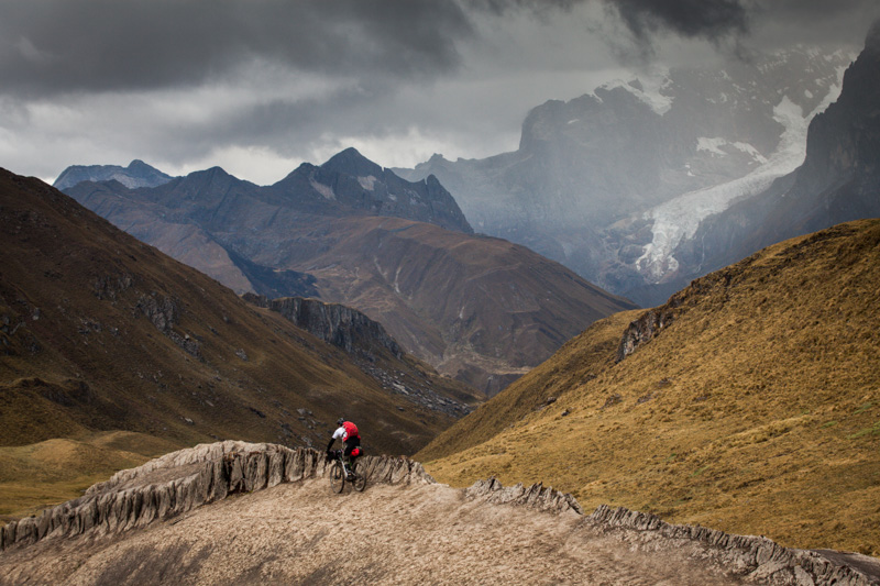
Still, what we did ride, from Llamac to Cajatambo – via four respectable passes – was as rewarding an adventure as we could have hoped for. Despite the extended sections of hiking, the majority of the trail was eminently rideable. To those who enjoy a challenge, these are hard fought trails, and all the sweeter for it: flowy, rocky, technical, awkward… and very satisfying. Perhaps it was the sense of place, or our toils, or the knowledge that so few tyres have rolled across these pampas before our own. Certainly, the Huayhuash ranks up there with the most memorable of bikepacks I’ve yet to take on…
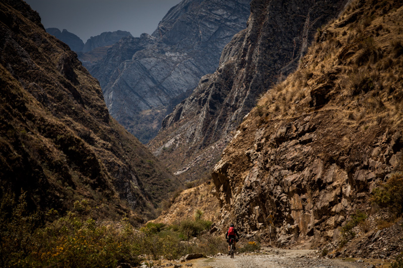
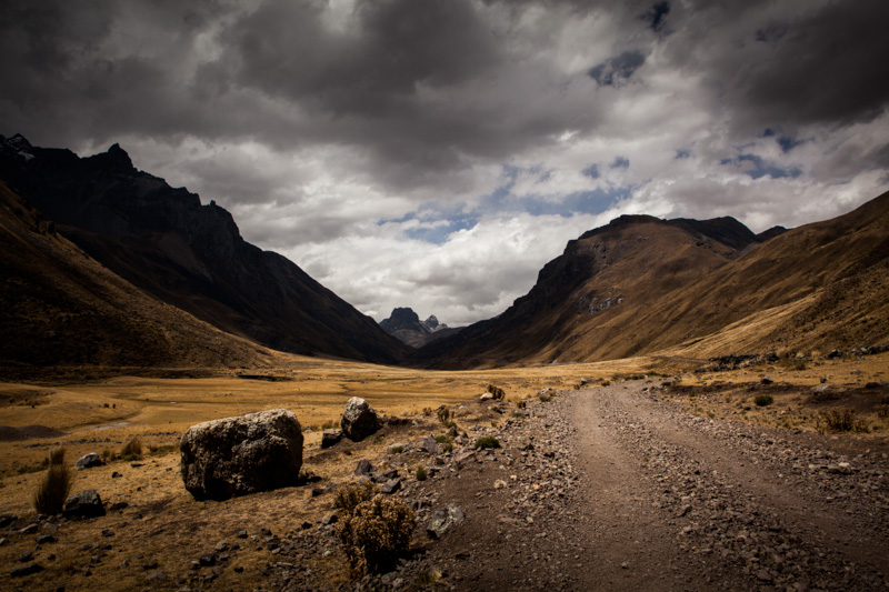
Our ride began sedately enough, following a dirt road from Llamac to Matacancha. Before mining enterprises developed the area (to much local consternation), this road was a ribbon of trail too.
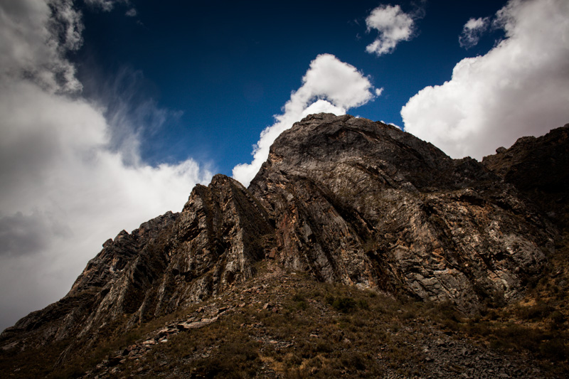
Powerful forces at play.
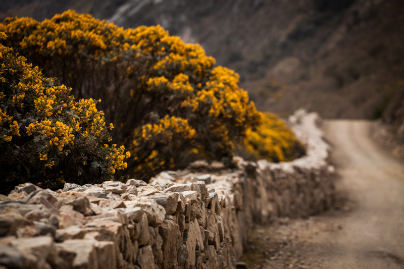
A stone wall worthy of the Cotswolds.
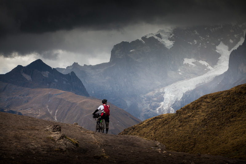
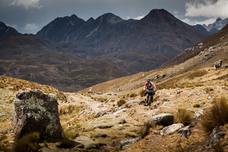
Onwards and upwards: there’s a 900m elevation gain from Llamac to the trailhead. A respectable warmup.
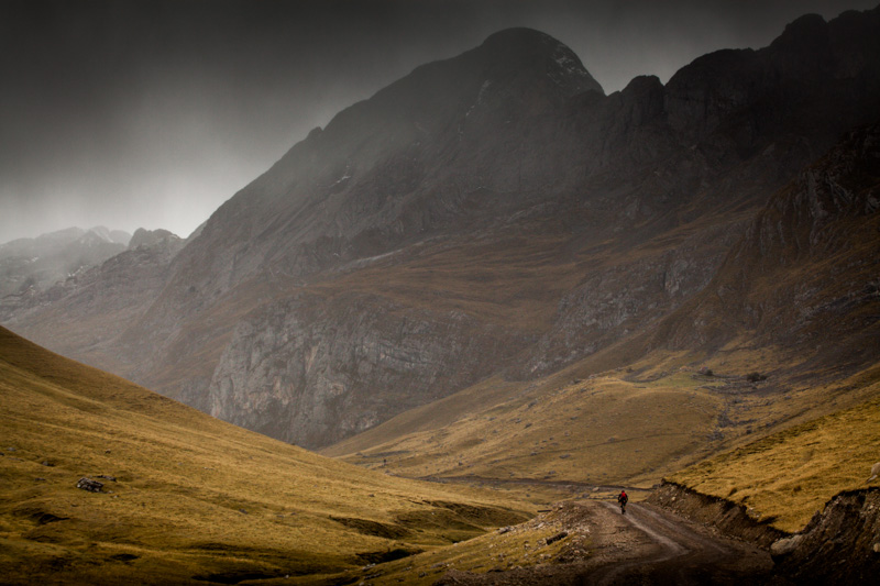
In theory, this is the dry season…
We’d planned to push on over Cacananpunta (4690m) on the first day, but heavy weather had us retreating to the warmth and comfort of our sleeping bags instead.
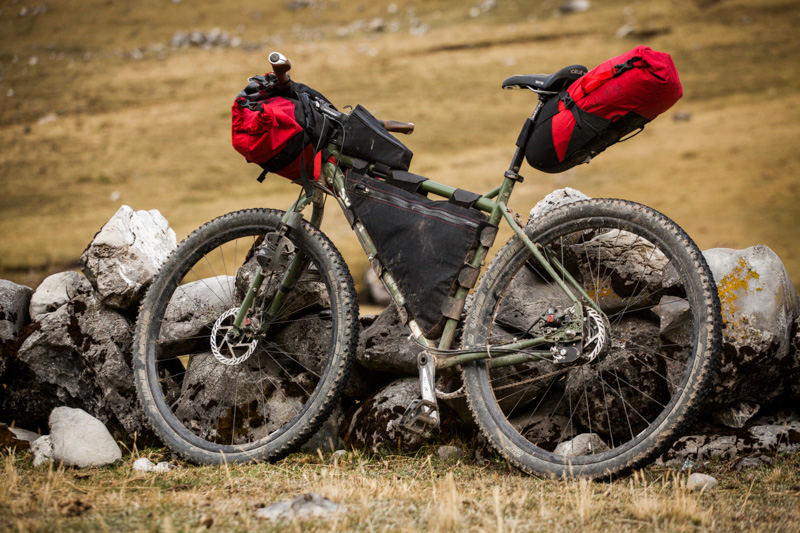
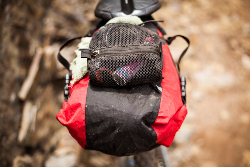
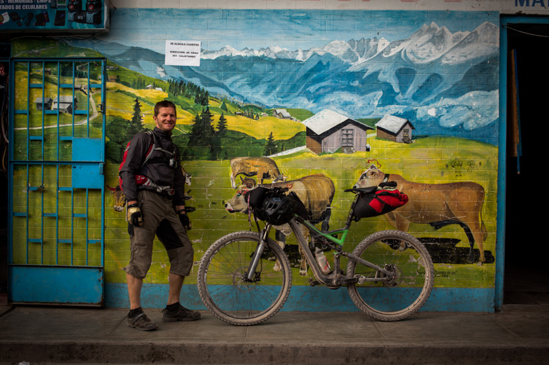
My steed. The Ogre, clad in finely crafted, lightweight Porcelain Rocket gear, and a capacious Revelate Gas Tank for snack stowage on the top tube. A 20l Osprey pack completed the setup, which I used to keep my camera handy – and protected from bumpy terrain.
Unfortunately it was still storming the next morning. This is the view from half way up the pass, looking down on a perfectly good dirt road that wends its way to Huallanca. But why ride your bike…
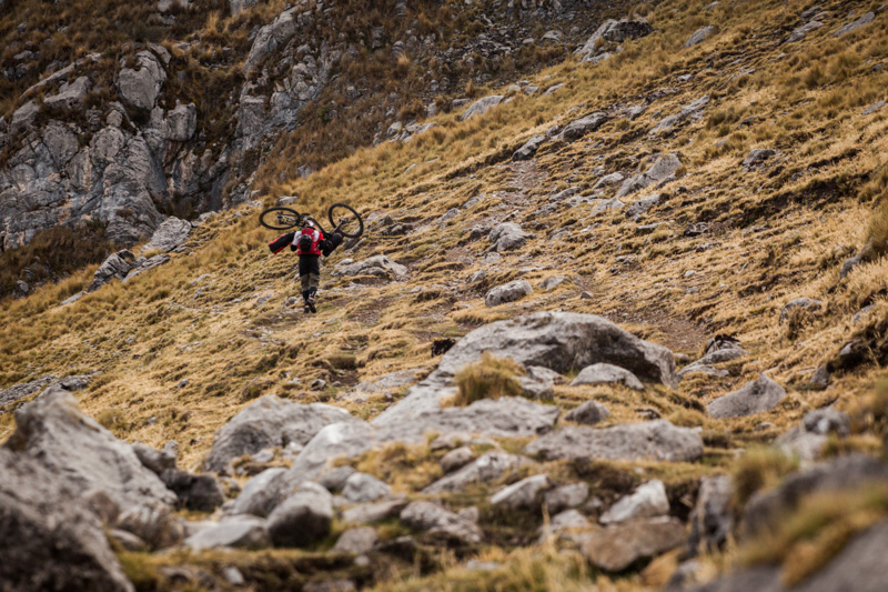
… when you can manhandle it over a mountain instead?
The reason? For those hard fought rewards that taste so sweet. The descent down the other side was a blissful one, and almost completely rideable.
Until, maybe, the snow/hail/sleet /climb kicked in.
Rain brings mud. Mud clogs frames. Above treeline – where no handy cleaning sticks are to be found – we settled on bleached white cow ribs instead, to declog drivetrains.
Atop the second pass and under a dramatic sky, a breather is called for. Carhuac Punta, 4630m.
Then, the dinosaur-spine drop in…
… feeding into a riproaring descent across open pampas…
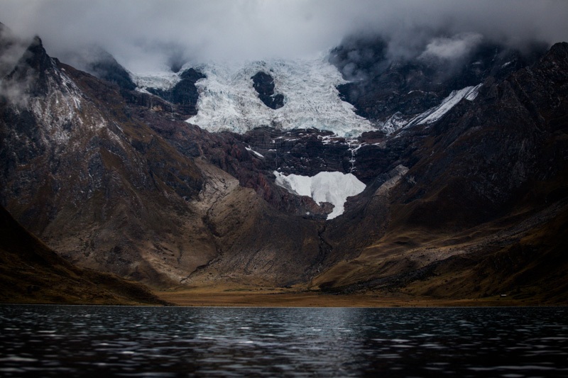
…. right down to the shores of lake Carhuachocha, at 4138m.
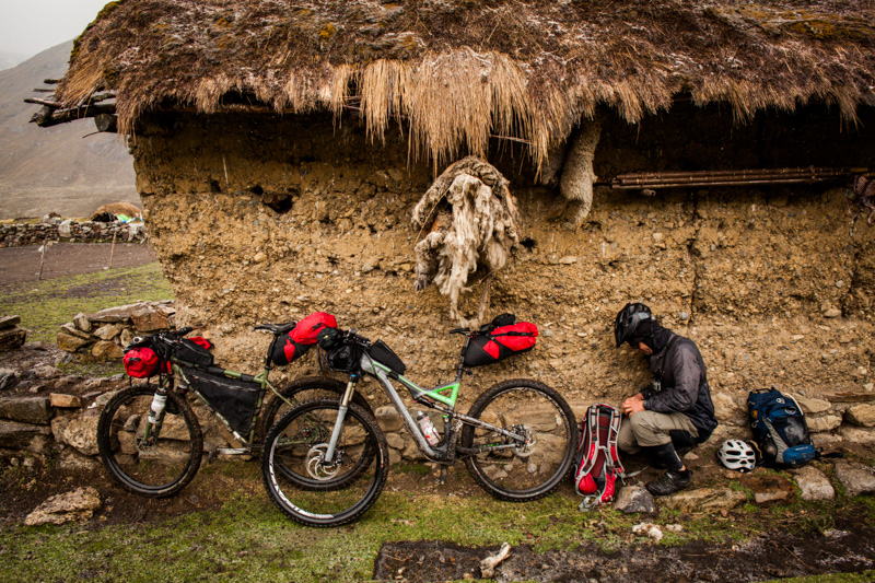
By now, rain was falling with renewed determination, so we sought refuge between a damp and pungent sheep skin…
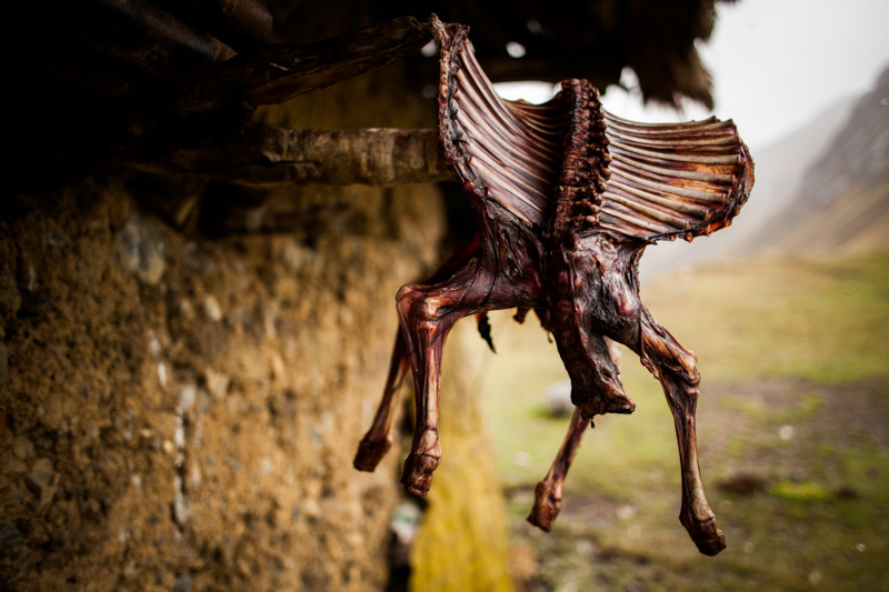
… and what appeared to be the xylophone-like form of a rabbit carcass.
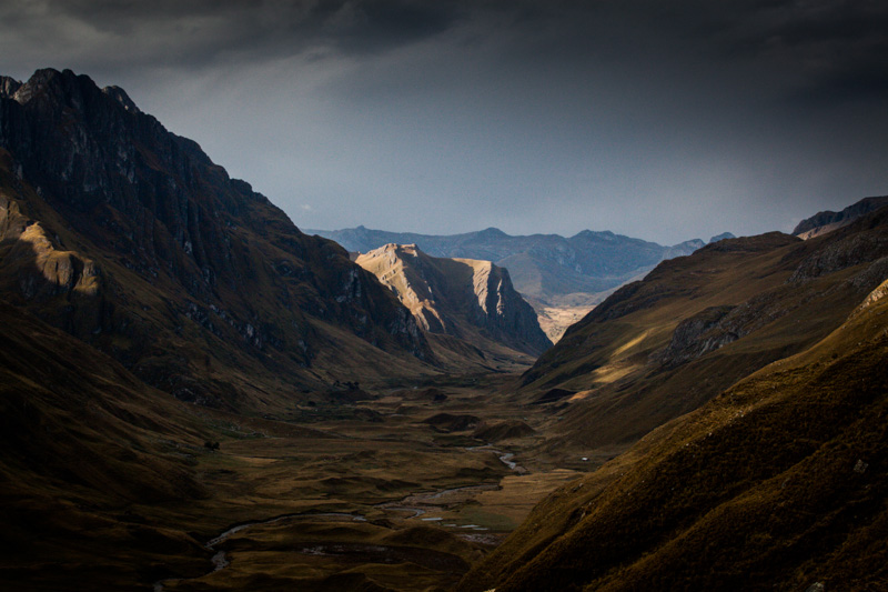
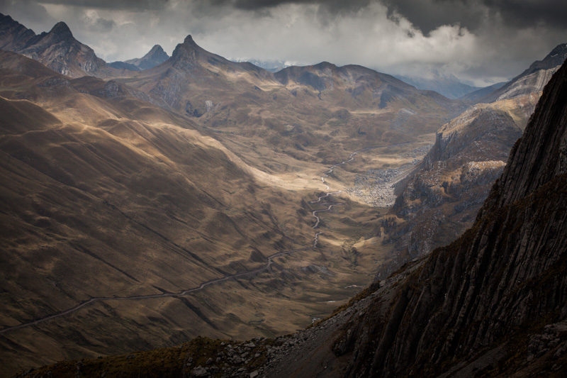
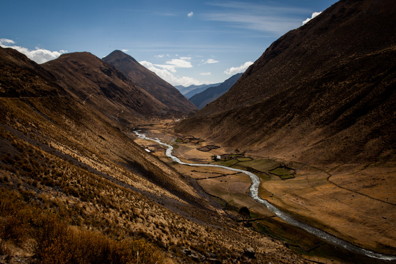
Views down the valley Carhuacocha river valley, as another tough climb had us gaining elevation fast.
Ah… the joys of pushing bikes.
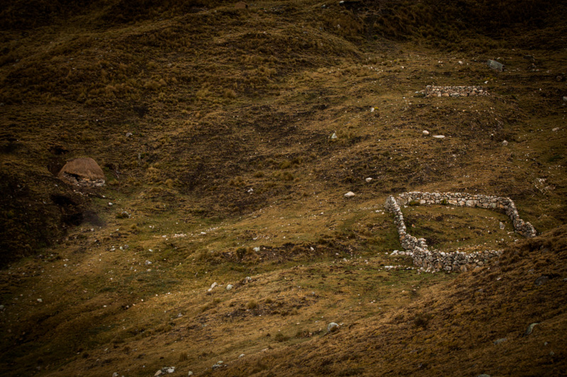
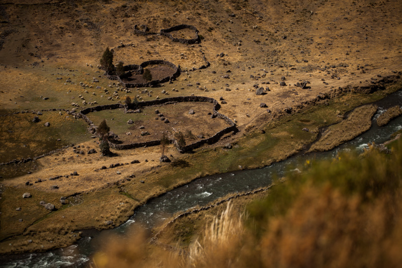
A chosita – a little rustic house – and a walled enclosure.
Sunshine at last. Our second camp site en route to Punta Carnicero.
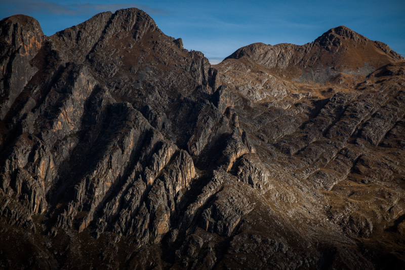
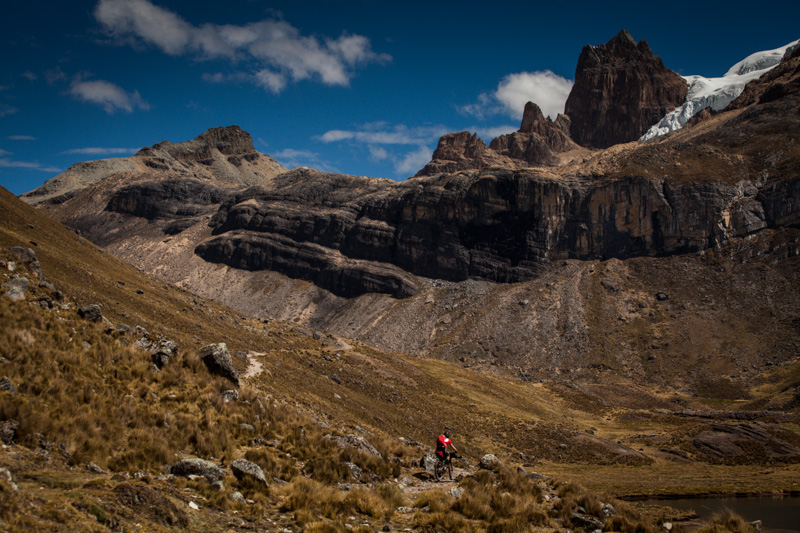
More rocky drama in the early morning light.
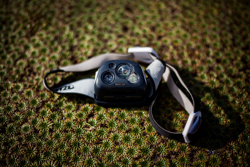
Allow me to indulge in some gear talk… This is my yet-to-be-released Petzl Tikka RXP. USB rechargeable, it provides up to 215 lumens of floodlighting, enough to illuminate any trail. The lighting is also reactive to what’s around you. Clever! There’s even a red LED mode, which is great for stealth camping. More thoughts on its impressive performance soon.
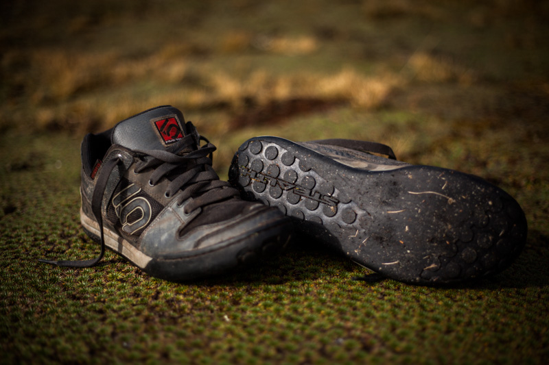
And my footware. Given the snow, rain and mud, my Five Ten Freerides were hardly an ideal choice for extended hike ‘a biking. But they do cling like superglue to pedals.
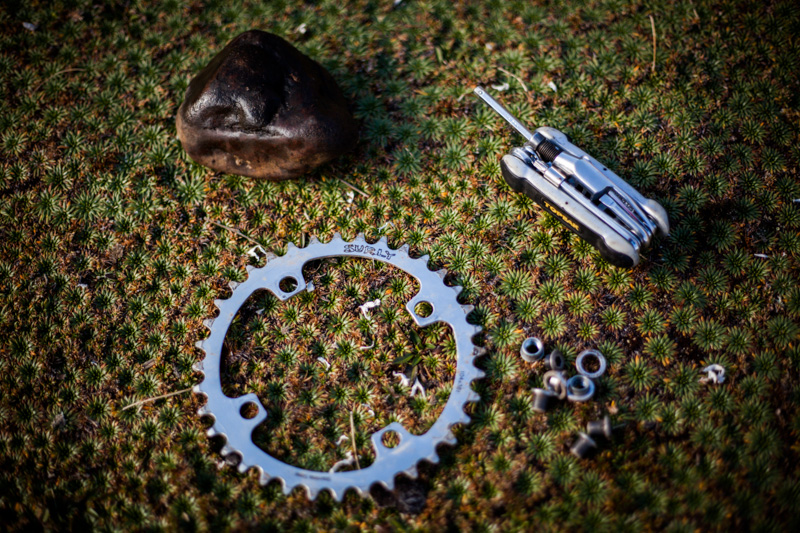
The neat thing about stainless steel chainrings… is that you can bash them back into shape if they take a knock in the middle of nowhere, as happened to mine. The Rohloff, incidentally, is performing flawlessly.
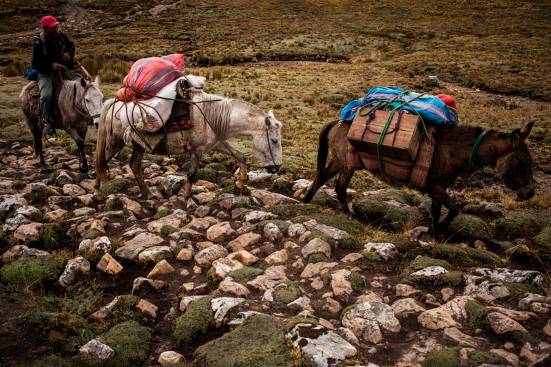
Despite our perceived macho prowess, later that morning we were unceremoniously overtaken – along a particularly gnarly section of trail – by the local donkeyman and his animals, providing support for one of the trekking groups.
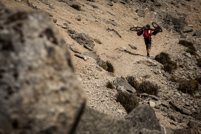
Some pushing required…
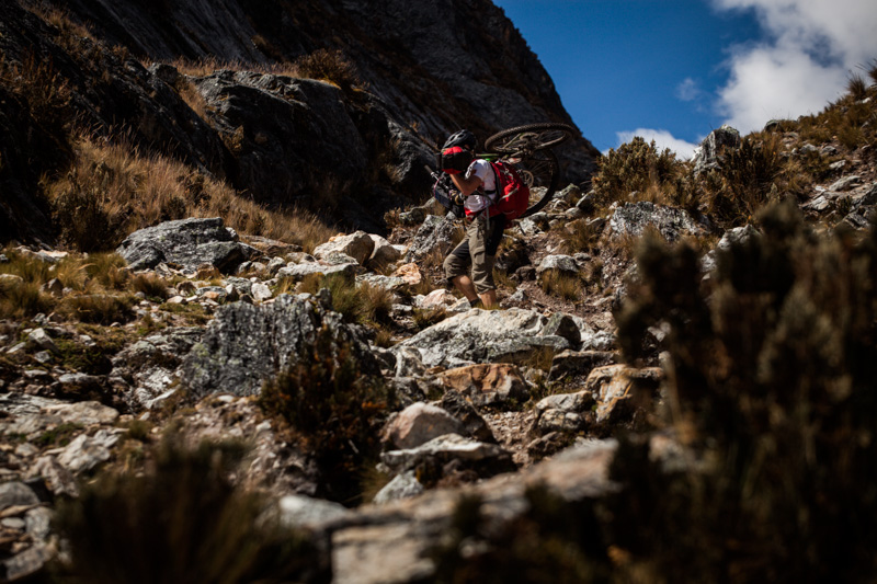
… and carrying too.
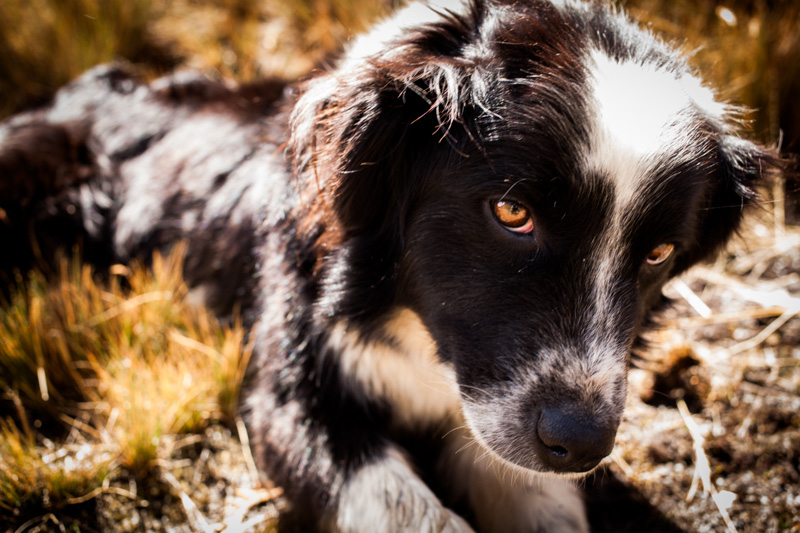
A trail companion.
Savouring the moment of arriving at Punta Carnicero, 4615m.
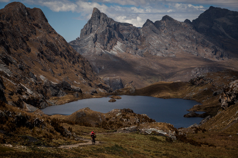
… before savouring the descent round Chocopatacocha.
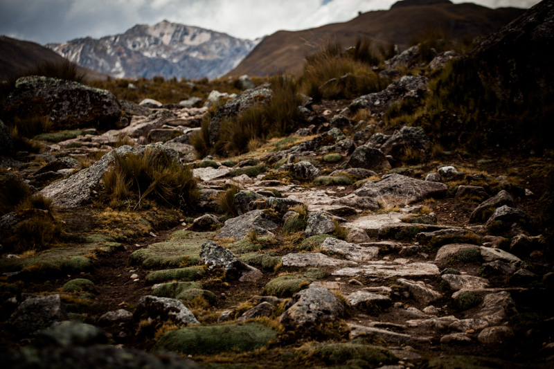
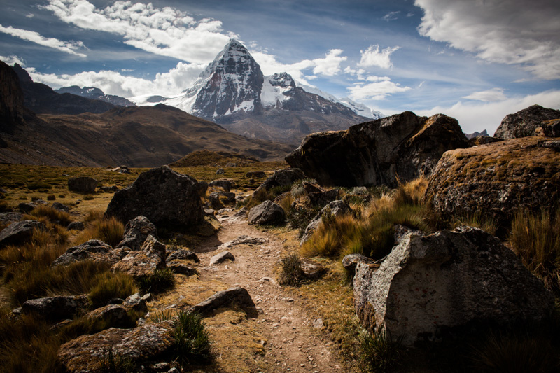
Picking our way through various boulder fields.
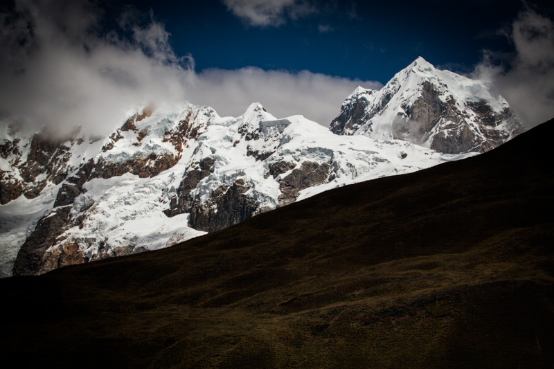
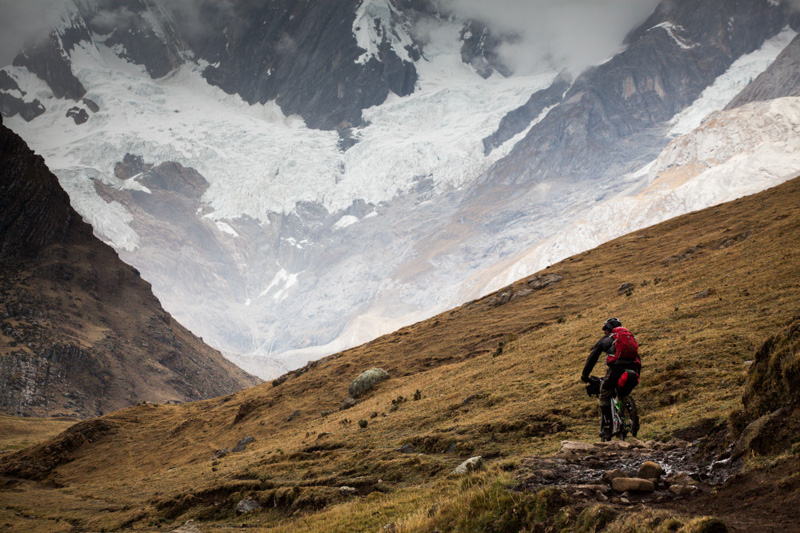
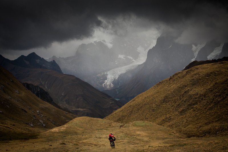
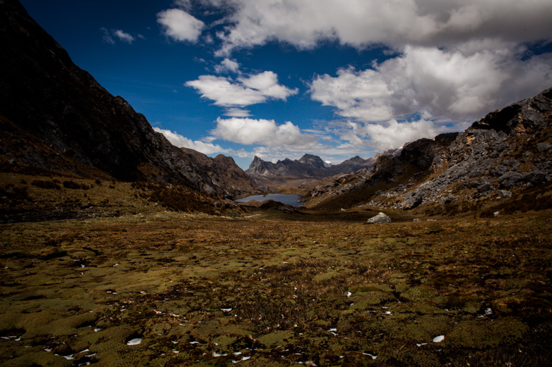
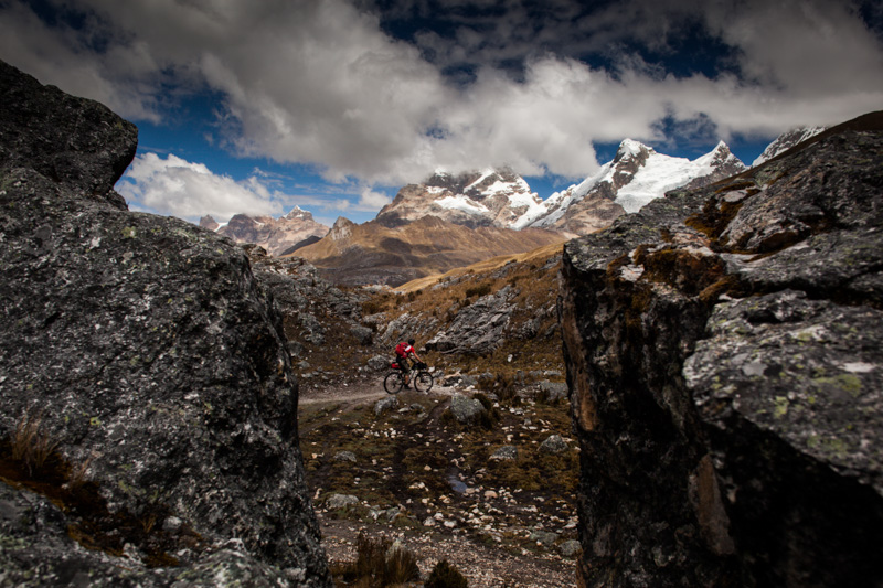
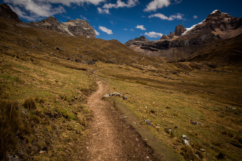
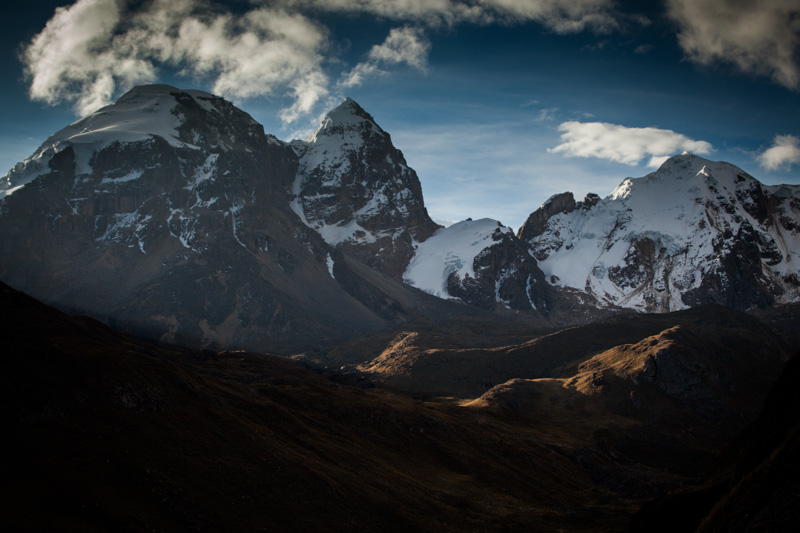
Although our route didn’t take us through the most majestic part of the Huayhuash – the fabled (but unrideable) Three Lakes – the views weren’t exactly bad…
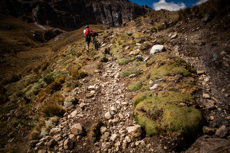
And the terrain definitely kept us focused. This is big wheel country – we were both riding 29ers, and appreciative of their rock-munching magic.
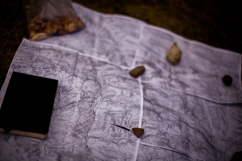
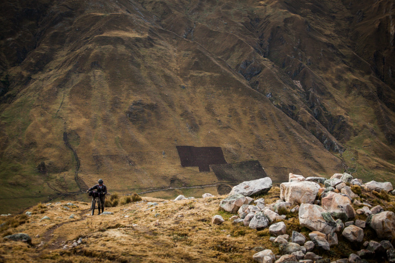
TIme to study the map, and see how many passes lie ahead…
Then, it’s back up towards the next ‘Punta’, along a section of trail that proved remarkably rideable.
Primo singletrack, if you have the lungs for it. (turns out riding trails at 4500m+ isn’t quite the same as barrelling around at sea level…)
Charlie, making it look easy. As the purveyor of the beautiful Llanaganuco Lodge, living at 3500m probably helps…
More gorgeous singletrack. Trails don’t get much better than this.
Peppered, of course, with respectable bouts of toil. A final push/carry/drag had us negotiating a moraine field.
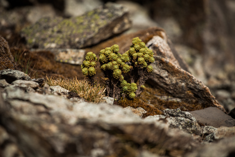
Mysterious floral delights to detract the mind and body.
Woohoo! One more pass down. Portachuelo de Huayhuash.
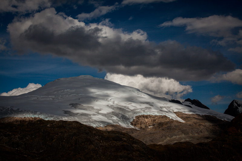
An impressive snow glacier on the descent down to Laguna Vicagonca.
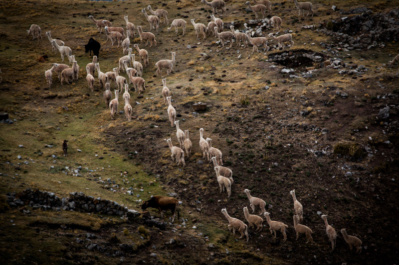
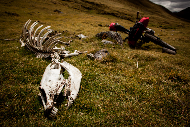
Just as cool, a pack of alpacas, native to the land. Sadly, very few are seen these days, having been largely replaced by cows, which are far more destructive to plant life.
With a hearty wind whistling trough the valley, we made haste to our next campsite.
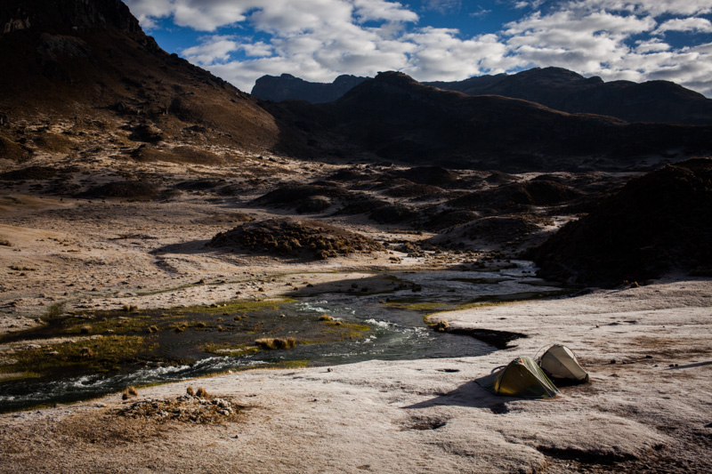
Fast forward to the following morning, waiting for the morning sun to hit. The Pumarinri River looks lovely and calm, doesn’t it?
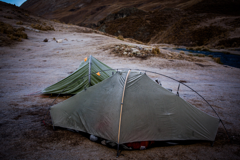
My Tarptent Moment, before the unfortunate rapid running incident.
It’s hard to convey the strength and scale of the rapid in this snippet of video, but hopefully you’ll get the idea…
To cut a long story short:
Charlie heads off to the nearby hot springs. Cass mans the fort (this particular area is known for horse-riding vagabonds, so it’s deemed best to take it in turns for a soak). A stout gust of wind whips the empty Tarptent into the nearby river. Cass lopes across the plains in pursuit. Triumphantly, he grabs tent but falls into river in the process. Current is strong. Frothy, roaring rapid approaches. Fast. Oh… dear…. Deep breath… Flash of life history… Much water is imbibed.
Thankfully, Cass manages to extricate himself before running a second set of rapids. Both emerge considerably worse off for wear. Tent is torn apart, poles deformed, broken or lost, Cass battered, bruised, and just a little traumatised. Limps back to camp, dragging bedraggled tent. Charlie returns, relaxed and refreshed, to find Cass writhing around on the ground. He smiles. Some kind of yoga move, he wonders, reaching for his camera. Cries for Ibuprofen send him instead to the First Aid cabinet. Drugs and ointments are duly administered, at which point both Charlie and Cass laugh heartily at ridiculousness of the situation, given all the challenging trails they’ve just negotiated these last few days…
Soberingly – had I hit my head – it could have been far, far worse. My watery journey might have continued to the Pacific!
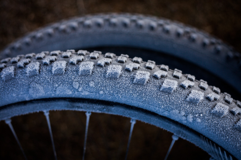
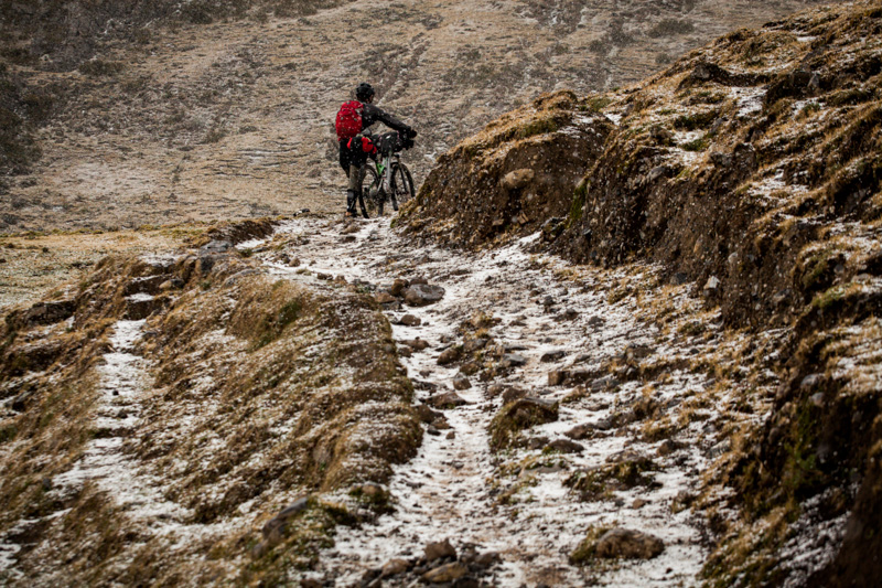
A chilly start to the day indeed. And not just for our bike tyres.
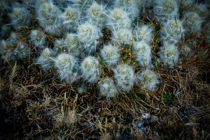
Andean, high altitude cacti. Almost like being back ‘home’ in New Mexico… I could have done with a bit of home at this point.
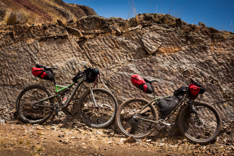
Still, the steeds soldiered on, so we did too. Pictured: my steel Ogre, and Charlie’s ‘stealthalized’ Spesh carbon Stumpjumper FSR Expert. That’s a fancy mouthful.
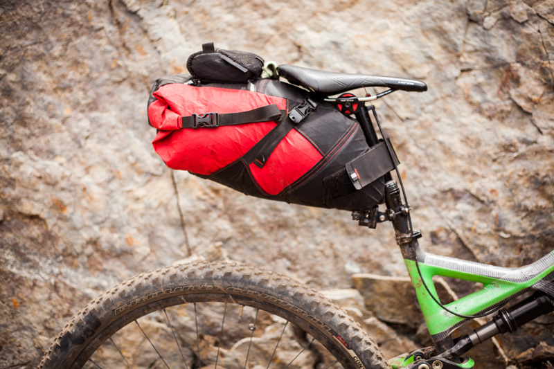
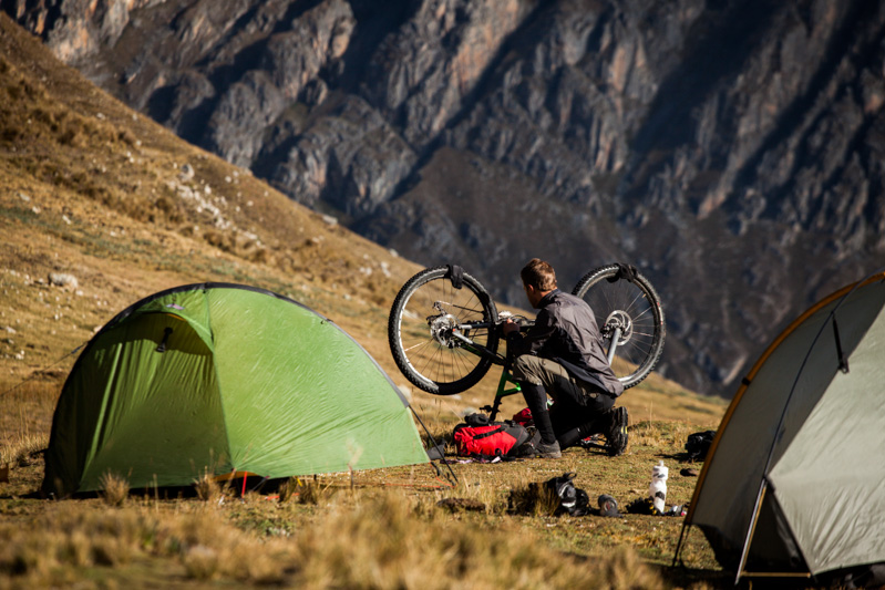
Charlie was delighted with his new Revelate Viscacha, which balloons out to offer up a voluminous 14L of stowage. Note that the shock chamber on his frame needed a few extra blasts of air, to make sure the underside of the pack didn’t rub on the rear wheel.
A nice detail: the little Sprocket marsupial pouch proved handy for snacks and sundries.
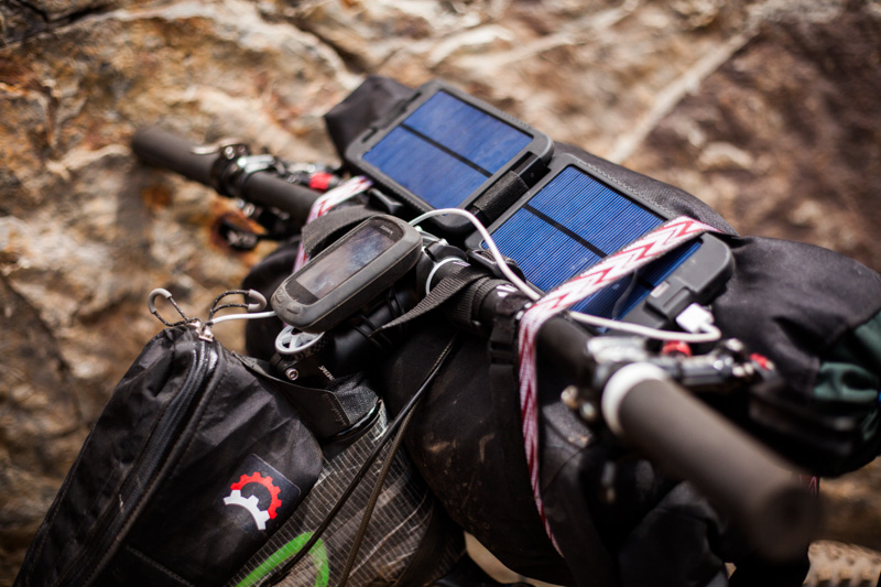
Being Mr Gadget, he was packing a Garmin 800/Go Pro Hero 3/iPhone 5, all of which could be juiced via a Powermonkey solar panel. The devices themselves lived in a Revelate Gas Tank whilst charging. On this occasion – given the tortoise-like speeds we were travelling at, a solar panel made more sense than my dynamo hub.
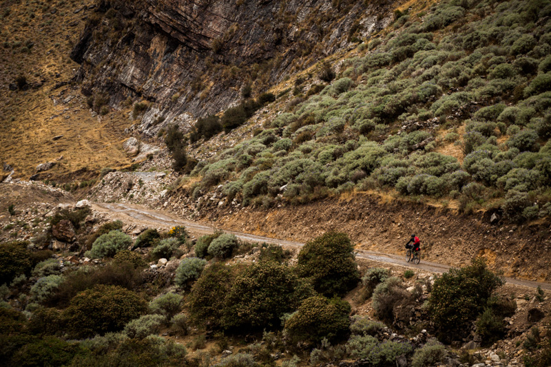
With my back and knee inflamed, we decided to take the road towards Huayllapa rather than tackling Punta Cayo, a pass that lies at a lofty 4950m. It proves to be a worthy evolution of our plans – eminently rideable, and ruggedly beautiful too. Definitely a more enjoyable alternative for cyclists.
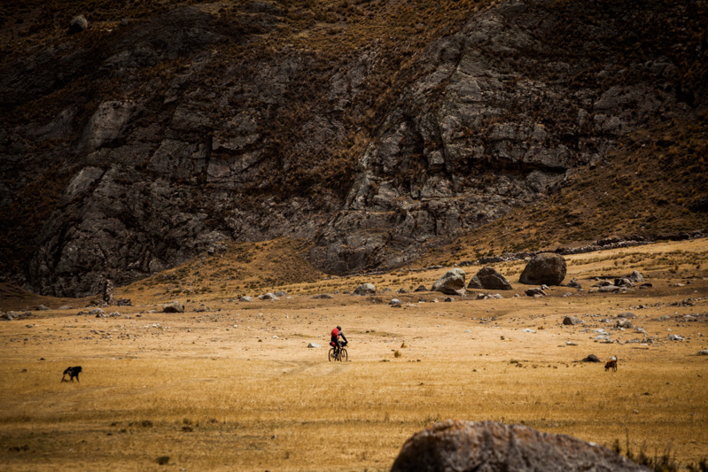
Cutting across the pampa, obligatory dog in hot pursuit.
And look at that. Not a portage in sight! Sometimes, riding a bike is good…
Climbing back out of the valley. At this point, we could have continued onwards towards Huayllapa, and rejoined the loop. But this would have required a 1300m hike ‘a bike en route back to Llamac – which body would have screamed about. So it was to Cajatambo that we set our sights on instead.
A series of idyllic small holdings could be seen, far below us, along the banks of the now sedate Rio Pumarinri.
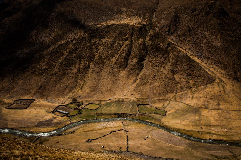
In fact, it was hard to imagine a more pristine and perfect spot for off-the-grid living.
And… after one more pass to contend with, our arrival in Cajatambo (3424m). Job well done!
A special thanks to Charlie – both for joining me, and for insisting we bring a First Aid pack. Your manly TLC, at a time that I was feeling distinctly sorry for myself, was much appreciated!
Some stats:
I couldn’t find any online info about riding the Huayhuash – though several people have completed the journey on two wheels in the past. So, for statheads, I’ll add in our day to day distances and altitude tallies soon. In the meantime, the total ascent is around 4000m, and the total distance around 91km from Llamac to Cajatambo. We also recorded a gpx file of the route, which I’ll try and upload. Otherwise, ask I can send it.
Recommendations:
Weather-willing, I would allow a day at Carhuachocha to hike up to the 3 Lakes. The views are said to be fantastic. Everyone we spoke to said it would be an ordeal to carry a bike up there.
Without the help of a donkey or two, I’m not sure I could recommend riding the whole loop. But even as a bikepacking traverse to Cajatambo (or even, Oyon), the Huayhuash is definitely a worthy adventure. If you are contemplating the full loop, riding the dirt road (it begins half an hour from the hot springs) to Yuallapa makes more sense for the cyclist. From there, it might be worth investing in the help of some four legged friends to carry your gear over the next pass – a climb of some 1300m – to make the return trip more enjoyable.
Food and Water:
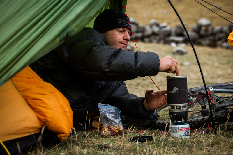
Luckily for us, Charlie had a bunch of dehydrated camping food (complete with desserts!) for dinners. Lunch was brown tortillas, parmesan and salami, along with nuts (cashews, almonds, Brazil) and dried fruit. Breakfast came by way of granola and oatmeal. All of these can be sourced from the market in Huaraz. Plus, tea and hot chocolate for evening hydration and warmth.
There’s no shortage of water on the trip. Both Charlie and I used Steripen Freedom UV purifiers, which worked extremely well. With ample streams to draw from, we only needed to carry two water bottles, at most.
Getting there:
We took at 5.30am El Rapido bus to Chiquián (10 Sol, plus 5 for each bike). Journey time is around 2 hours. Then, we hopped on the local Nazario bus to Llamac, which leaves at 8am. The distance is far shorter, but the time take is similar as it’s an unpaved road. In fact, this section would be very nice to ride, as would the segment to from Huaraz to Chiquian – especially if you stopped by the impressive Hatun Machay, the sprawling rock forest, on your way out.
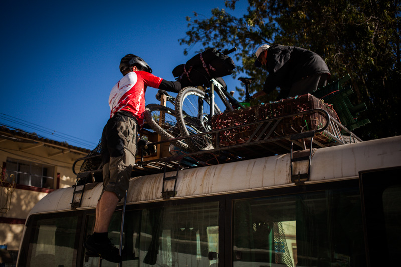
Lashing on the bikes for the bumpy ride to Llamac. Pad/tape your frame/shock if possible.
Getting back:
We took public transport from Cajatambo to Huaraz, the first leg of which was in a chicken-shit stained bus (really, the windows were covered), that descended down to the coast (dirt). There’s only one a day, and it leaves at 5.30am. From there, you can connect with a midday bus back up in the Cordillera again (paved, 4 hours). Total time: 10, long and relatively uncomfortable hours. According to Google Maps, there is a way to ride back without dropping all the way down to the coast, linking up with the road to Conococha.
Alternatively, we could (had I not had my incident) continued to close the loop, but this would have included a 1300m elevation gain (over Tapush Punta) up a largely unrideable trail. From what we heard, the descent down the other side isn’t much better either. Perhap it’s best to employ the help of four legged friends if doing so, which should be easy enough to do in Huayllapa. From Llamac, there’s a 11.30am bus back to Huaraz.
Maps:
The best map of the area is probably the Apenvereinskarte Cordillera Huayhuash. It’s available locally, but cheaper if sourced in Europe. We also used an iPhone and the excellent Gaia App – it seemed like OpenCycleMap had the best detail for the area. The trekking route was even marked.
Setup:
You can read about my setup here.
Timeline:
We took the early bus early to Llamac. Then we rode to Matacancha (the start of the trail), where we camped early in the day, due to a storm. The second night we camped en route to Punta Carnicero, which involved crossing 2.5 passes – a hard day. Our third night was at the hot springs (1.5 passes), and our fourth in Cajatambo (predominantly dirt).
Fees:
Unlike the Cordillera Blanca,the Huayhuash isn’t a National Park. Each community demands a fee for passing through and/or camping. In theory, the total should amount to around 190 Sol, to complete the circuit. It’s all relatively official, with a receipt for each payment – which varies from 10-40 Sol at a time. Make sure you’re given one, both in case you are asked for it later, and as the fee collector may otherwise be pocketing the cash for themselves. (At the hot springs, for instance, we were told the ticket book wasn’t on site – until we insisted, when ‘another’ mysteriously appeared!) At the time of writing, payments should amount to around 110 Sol ($40) to reach the hot springs at Viconga. There’s been some security issues in the area over the last few years, so you’re advised not to try and fare dodge, and incur the wrath of the locals.
Finally:
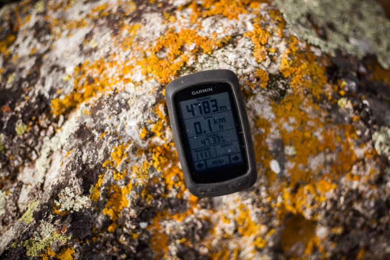
Charlie took some great GoPro footage, but it will needs to be edited. In the meantime, this is just a couple of minutes chopped from one our favourite sections of trail – the traverse and descent from Portachuelo de Huayhuash, 4783m.

You are killing me here; Huayhaush looks amazing! And nice third-person narrative for the rapid incident… glad everything is OK.
Great post, bro. The part with the bad weather took me right back to Kirgystan. Hope the aching, battered limbs are on the mend. Love from the Wimbledon branch xx
Mending slowly. Hobbling around like old man. Knee still gammy. No cycling for me, for a bit at least )-:
Jeez, thank God you made it out of those rapids! Sounds very gnarly! Great report, I’m looking forward to getting down there immensely, just several 1000 kms to go…
Hey amigo,
That looks like a great epic ride. A must do…
Iam glad you are back in the Andes and happy that the river didn’t take you for a longer ride, ufff!.
Drink some chicha pana it helps recover the emotional shock…
great pics!
Wow quite a trip, hope you are recovering well. Any bugs this time of year? I am planning a trip for July 2014.
Valentine – thankfully, the area seems completely bereft of bugs.
Ouch! Pain hurts! That river thing could have gone another way, and not a good one. I’m happy that you survived. Having been in more than a few such predicaments in my time, I know about the suck-it-up-and-survive factor. Adrenaline is an amazing thing.
Get some sunshine on those bones and everything will be alright. Also, now I want a donkey.
tj
Adrenaline is indeed a wondrous thing. I thank it for getting out of the water before the next flight of rapids… Though it leaves you feeling a bit weird and depleted after the event…
fucking rad
Congratulations for your trip and amazing photos, you have a lot of courage… for sure you inspiring me to make adventures with my bike…
Whoa, amazing tales and breathtaking photos as usual. A can’t wait to get down there and attempt something similar.
Can you please send me the GPX files for your route?
forgot to say… wishing you a speedy recovery!
Sure thing. It’s a big file (9MB, for some reason), so when I get the chance to upload, I will. Remind me otherwise. It’s not quite from the beginning, but you’ll see clear enough if you import it into Google Earth.
I’m on the mend. Slowly…
Availability of replacement parts aside, how much do you miss the Krampus+Knards in this terrain? I imagine 29+ or even fat wheels would have been welcome on those rocky stretches, especially after your whitewater incident.
A speedy recovery to you.
Bob, that’s a great question. Yes, the 29+ platform would have been awesome on this ride, and I missed it dearly – extra carrying weight aside… As you say, running a lower tyre pressure would have provided some nice cushion for my sore back. And, it would have helped me keep up with Charlie on his full susser!
Overall though, I’m very happy to be on the Ogre, as my journey will involve plenty of graded dirt/road stretches, where a standard 29er tyre is more than ample. Inevitably, on a long trip like this, there’s often times you wish for a more optimised setup – but in terms of sweet spots, the Ogre does a great job. After all, these bikepacking adventures are fantastic side trips, rather than the staple of the ride.
Which is not to say I haven’t ruled out making a frame swap (easily done with the Rohloff) somewhere down the road!
awesome stuff – words, pictures and efforts! heal well and fast…
Beautiful pictures and ride report Cass. I am glad the river incident turned out as well as it did. Good luck with the rest of your adventure.
Jim
Funny coincidences; I just returned to the US after spending 5 weeks in Peru in Bolivia. Major highlight; camping high in the mountains near Lake Titicaca AND I just crashed a mountain bike an suffered a fractured pelvis. Sitting at the computer reading your excellent ride report evokes mixed emotions…
WOW Cass! I had read this episode too quickly and mainly looked at the pictures, completly glanced over the part where you almost drowned!!! My wife Sarah (who also became a Cass-follower) drew my attention to it…
Take care and recover soon! it’s amazing how suddenly danger can appear unexpectedly, take care!
( I meanwhile have left Nepal and apart from our stint in Ecuador in your tracks, am working in Belgium, cycling bug didn’t leave me, however and am commuting to work every day on the bike, 50 km one way, so i’m getting strong for the next dirt road adventure next year) all the best and be safe
sten
Thanks for the comments. Recovering is proving to be a slow process – but I certainly don’t regret doing the ride!
Sten – I’m glad to hear you’ve been bitten by the dirt road touring bug (-:
Excellent write up Cass, glad you didn´t bash your head in, we would all have missed out on the Blog!!! sorry I wasn´t there to save you when you threw yourself in to the rapids – still not convinced you didn´t do it – to take one for the blog!!! 😉
wishing you a fast recovery.
Really lovely stuff Cass. I’m a bit behind the times, Central Asia does that to you. Here’s hoping you mend up quickly so you can produce more of these fantastic pictures and stories.
Cass, these are really very nice photos of the Huayhuash. Really enjoyed the series.
Pingback: Peru's Huayhuash for girls and boys | Trails and Tours
Cass, always amazing…. glad you survived to tell another epic tale. Just back from my 5th trip to the himalayas – hard to believe it!
Glad you are feeling better and things didn’t end up worse in that river!
I spent a night in a Tarp Tent in the Mojave where I thought we were both going to take flight!
Can you get a new tent locally on tour?
cheers,
Vik
Thankfully, managed to get mine repaired, and borrowed a pole. So I’m back in action!
good Job..!!!!.
great adventure… I have no to much words to say more than excellent wonderful, mountain biking
please send the map and route that you have created please to my email info@perullamatrek.com
Great post, but let’s be honest, Huayhuash makes for a bloody hard bikepacking route…. Definitely the domain of the masochists.
Cheers
Paul
Thanks for the message Paul.
I’m not one for beating myself up for no reason, and actually found the ratio of riding to pushing pretty good on the Huayhuash (and the singletrack to be aweomse). But I only did it in one direction, and I heard the return leg is the really challenging bit. Certainly, I found the ride a whole lot more satisfying than the Santa Cruz trek (interestingly, another rider who contacted me found that one absolutely fine). So I guess there’s always a fair bit of interpretation to be done with what’s worth riding and what isn’t, as well as changing trail conditions year by year, and probably the kind of bike you’re on too.
Yep, fair points. To be honest I was basing that only on having ‘ridden’ the first pass north of llamac and hiked the more challenging half of the circuit. In any case, a cracking place to explore…
Keep up the good work
Cheers
Hi Cass!
I’m planning a bikepacking trip to the Huayhuash this December. I am so glad to discover your website and all your incredible, generous resources in my search for info on backpacking in the Huayhuash. I would love to take a look at your maps/GPS files if you are willing to share them, or just get a little bit more specific guidance on a recommended route if you have the time, please email art@sarahuhl.com
thanks so much!
Sarah
Hey Sarah,
Great to hear from. I don’t have the gpx to hand (they’re easy to track down online though, wikiloc.com is a good place for gpx files in South America). I may be able to dig up some pdfs of the maps though, will have a rummage.
I don’t have much more to offer by way of advice other than what I’ve listed in this post – but check out the other bikepacking-style rides I did in the area (search Peru in the blog). Also, well worth seeking out is Hiking And Biking in the Cordillera Blanca and Huayhuash, published by Trailblazer (http://www.amazon.com/Perus-Cordilleras-Blanca-Huayhuash-Trailblazer/dp/1905864639). That has a bunch of great ideas.
On a general note, I loved the ride (or as much as I did). But being honest, it definitely involves its fare share of hike a bikes. There are perhaps more satisfying bike rides in the area as far as ratios go… but the trails in the Huayhuash, when you hit them, are challenging and beautiful.
Will huayhuash still be ok considering it’ll be entering raining season? Or is that not an issue do you think?
Not sure how enjoyable it would be in heavy rain… I guess you’ll have to just see how it pans out closer to the time. We had pretty bad weather (and it was the dry season) but we still had a lot of fun.
Hi Cass,
Very nice post, good pictures and very informative. I saw that you don’t have the gpx anymore (and I could only fid this in Wikiloc: http://www.wikiloc.com/wikiloc/view.do?id=6804764). Do you have one of this PDFs you were talking about?
Thanks for your posts, keep it up.
I’m afraid I can’t track them down at the moment. But you should be just fine with a gpx file and a basemap. I use an iPhone and Gaia to navigate. It’s a well-trodden path, so not too many issues.
Enjoy!