
I’m back from a hearty three and a half day, triple pass medley – via Punta Olympica (4890m), Pupash (4050m) and Portachuelo de Llanganuco (4676m).
Heading south? If there’s one biking detour to do in the Cordillera Blanca, then this would have to be it. In fact, listening to other bike tourers better versed in riding the big mountains of South America than I am, this is an undertaking that ranks up there with the very best of Andean visuals. And given everything that still lies ahead (Bolivia, Northern Argentina et al), that’s really saying something.
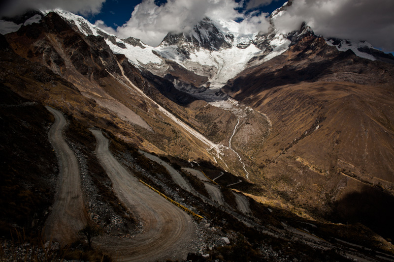
Horseshoe in shape, the route crosses the main branch of the Cordillera Blanca twice. The brunt of the beast – the climb up and over Punta Olympica (4890m) – has recently been endowed with a fresh coat of pavement, an event I’d normally lament. But in the case of this particular pass, the tarmac is so very buttery smooth (at least before the vagaries of a few passing seasons have left their mark), the way is so bereft of traffic, and the scenery is of such an imposing, close-up beauty, that I’m very happy to have let go of my dirt-road bias for now. Honestly, Punta Olympica has to rank up there amongst my all time favourite passes thus far, Himalayas included.
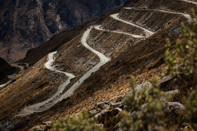
Portachuelo de Llanganuco (4676m), on the return leg, is certainly no slouch either, boasting some 34, tightly woven switchbacks almost within eyeshot. And, let’s not forget diminutive Pupash (a mere 4050m in height), the hurdle that links these two goliaths via a little-used backroad – providing a pleasant interlude to the more obvious drama of towering ice walls and lofty mountain peaks…
Indeed, this is a ride of both great beauty and great numbers. More stats will thus have to be compiled. But in the meantime, I know there was a 2240m climb from 2650m to 4890m. Then a 1250m ascent from 2800m to 4050m. And another from 3400m to 4676m, all in consecutive days. Plus all the descents in between…
Thanks Ben for joining me on this one – it was great to share the ride with you.
34. But we may have lost count…
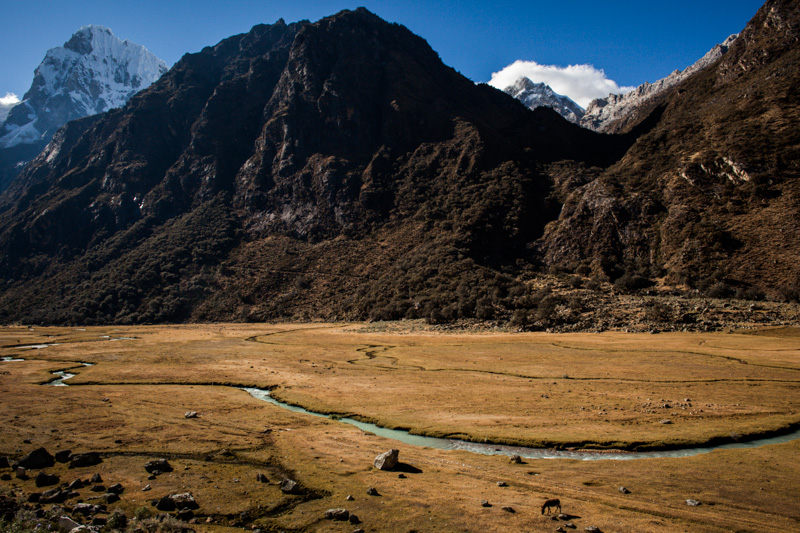
Down low. The first perfect pampa beyond Caruaz.
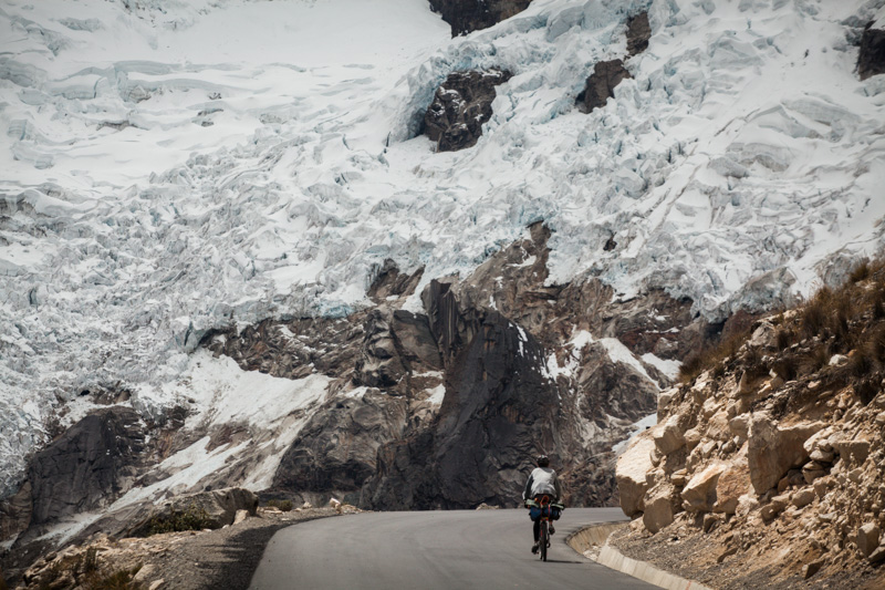
Up close. En route towards Punta Olympica, the highest point of the ride.
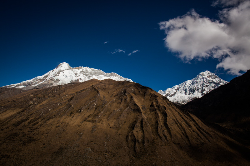
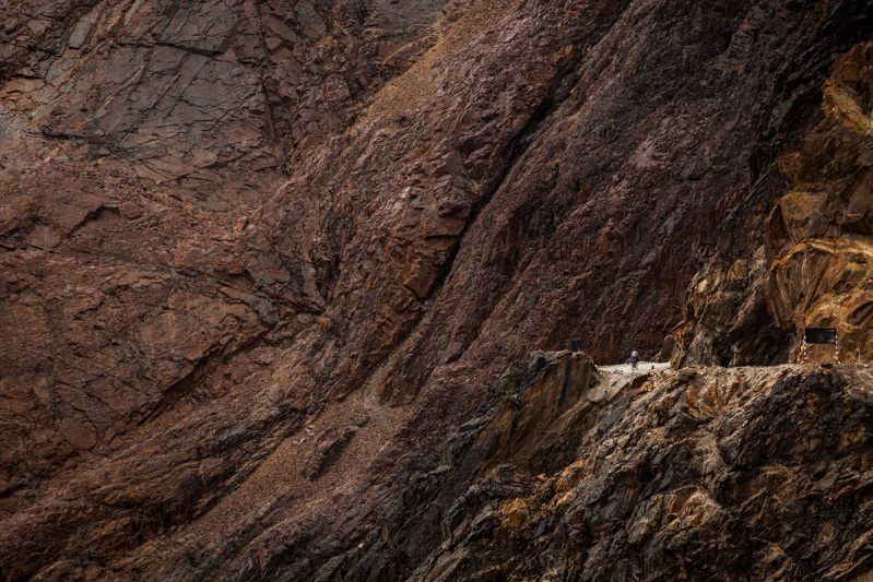
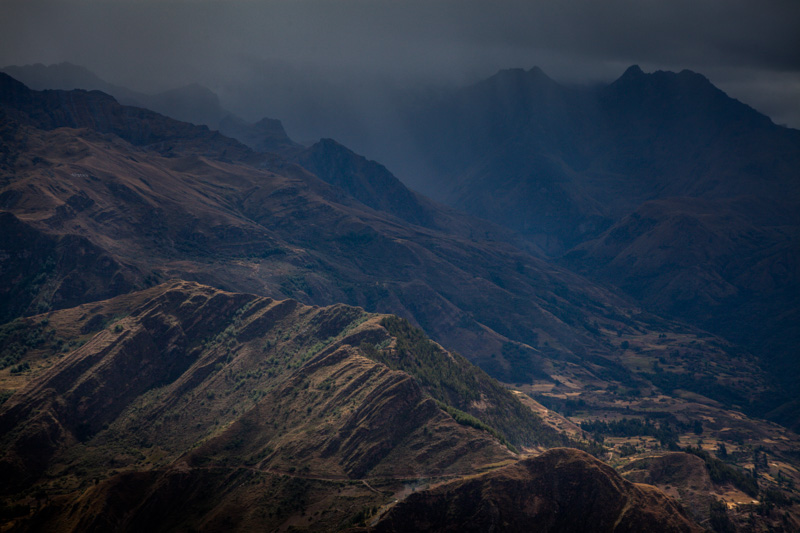
Jurassic textures abound.
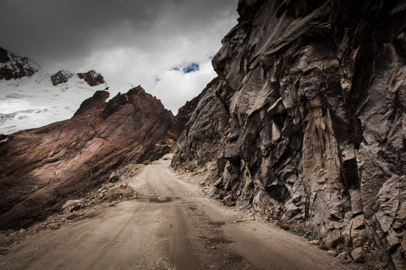
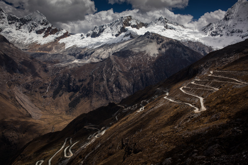
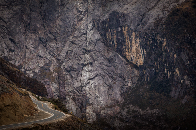
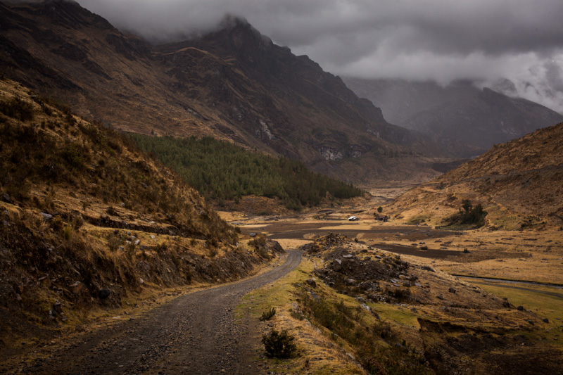
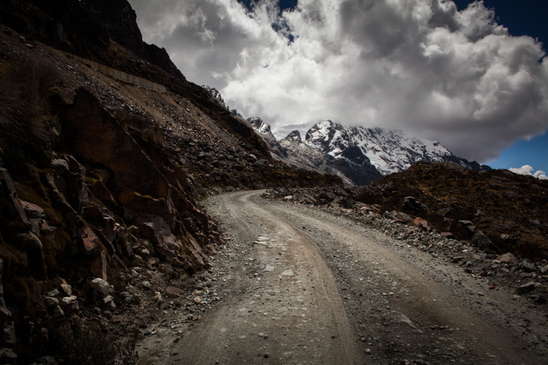
Rough and Rugged. Pavement gives way to dirt – Punta Olympica is only a few tortuous kilometres away…
A mere blip.
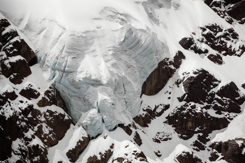
A scoop of meringue at the top of the pass.
And a swimming pool on the way down…
Back down we go.
Down, down, down, following the most perfect ribbon of freshly laid pavement.
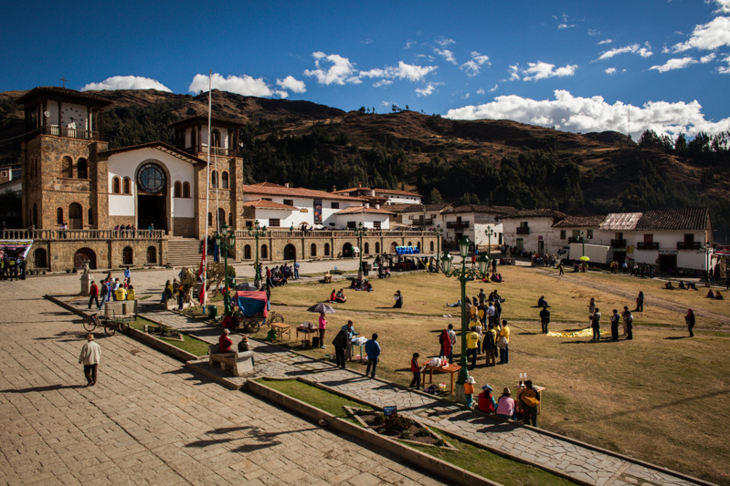
A festive Chacas provides a good spot to resupply.
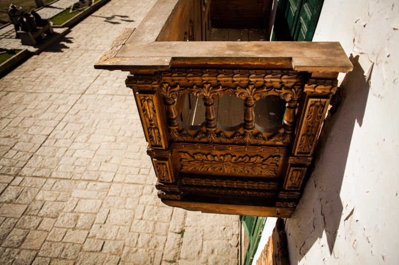
Chacas detail; the work of Italian mastercraftsmen Don Bosco.
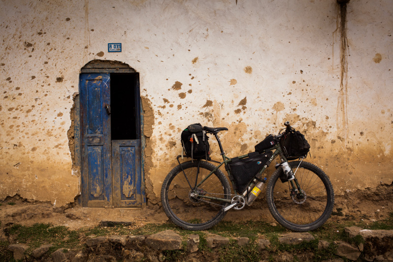
The Rig. Ogre+Carradice+Bagman+Porcelain Rocket+Revelate!
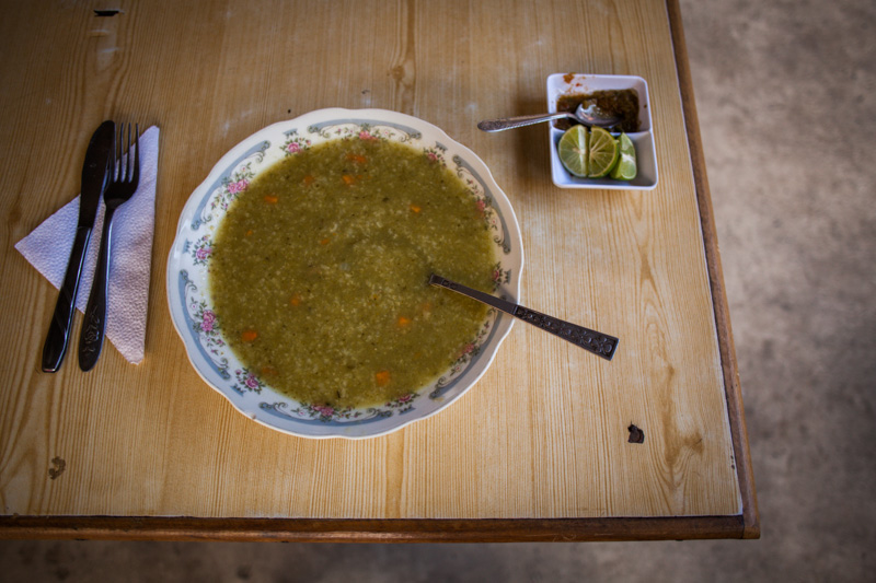
The fuel. Round one of a ‘Menu’, a set lunch that will typically set you back 5 Sol (less than $2).
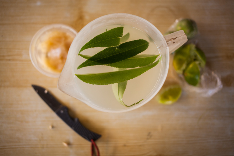
The medicine. A local leaf (along with lemon and dollops of honey) keeps my cough at bay.
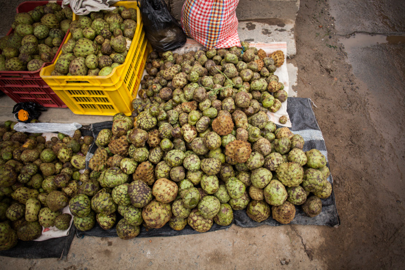
Strange Fruit. Chirimoya, soft and sweet on the inside, native to the Andes.
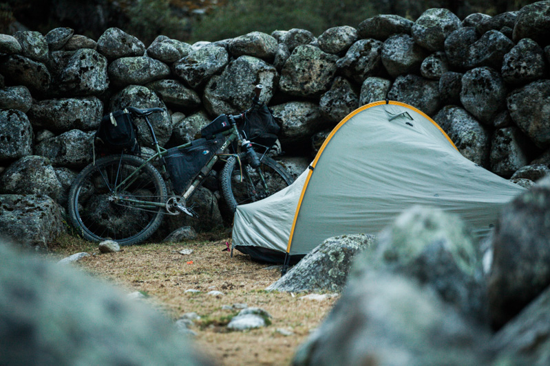
The camping. The Tarptent Moment nestles in amongst an abandoned animal enclosure.
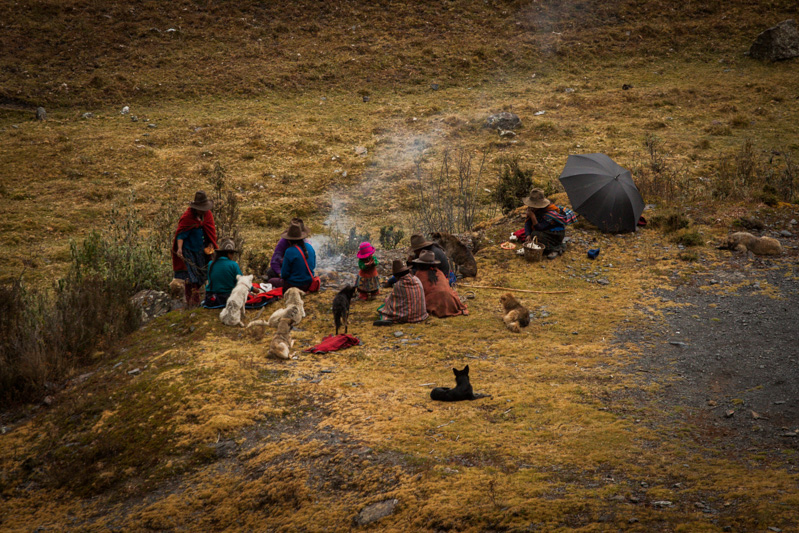
The locals. Note brightly attired, hardy child.
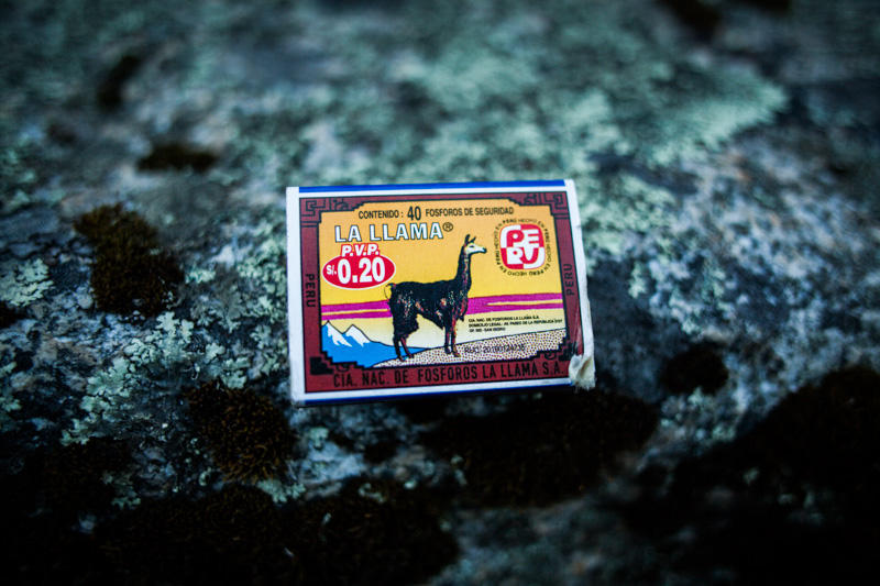
The Andean Icon.
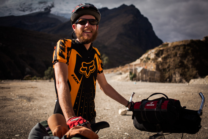
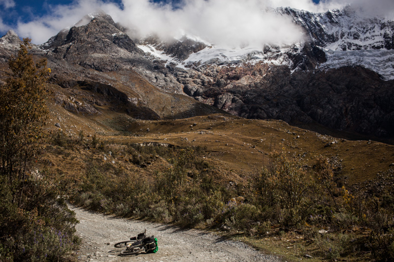
Ben. Note makeshift Husky toolbag lashed onto the handlebars.
Scotland? At 3500m, perhaps. A remote pampa marks the final climb to Pupash.
There be dragons.
In Yanama, a mural decrees the importance of schooling and literacy.
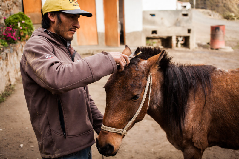
Haircut in Vaqueria, 3700m. These donkeys are used on the popular Santa Cruz trek.
And back up again.
A breather.
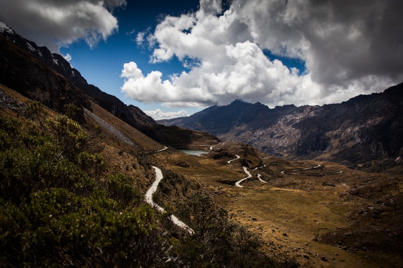
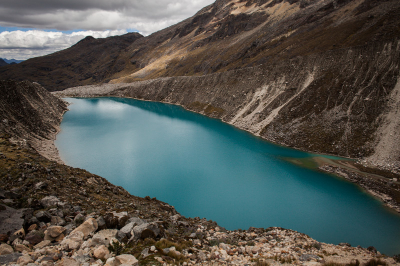
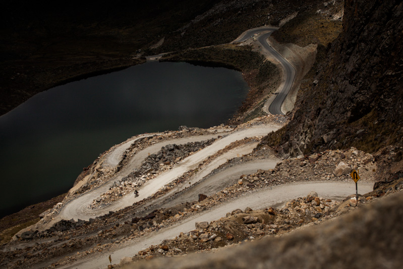
Almost there. Ethereal bodies of water mark the last few kilometres to Portachuelo de Llanganuco.
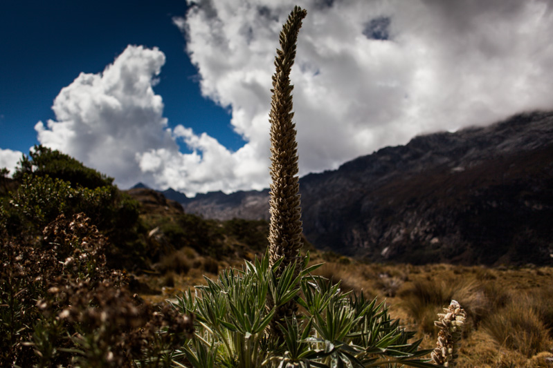
Roadside companions of a floral kind.
Finally, up and over. 4676m. More curly…
…whirlyness on the way down.
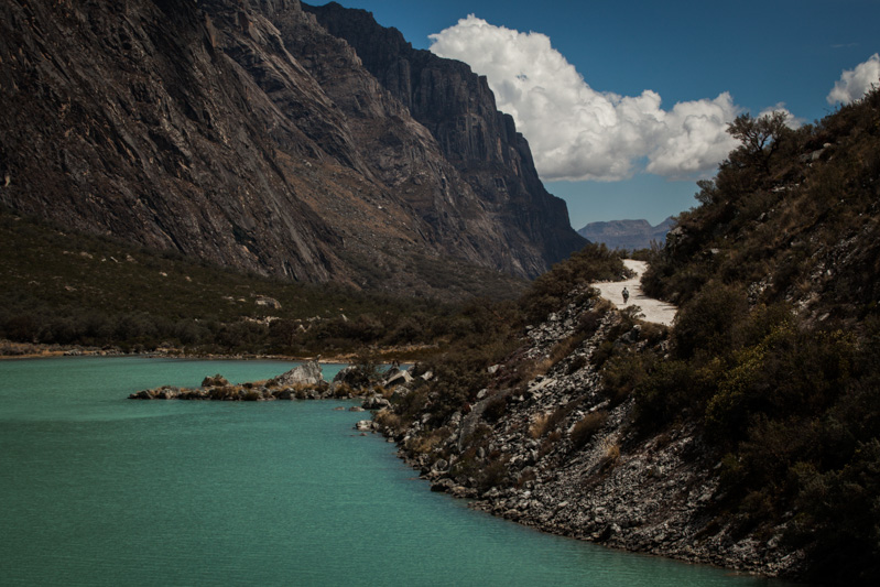
Llanganuco Lake. Another 1000m plummet to go to Yungay…
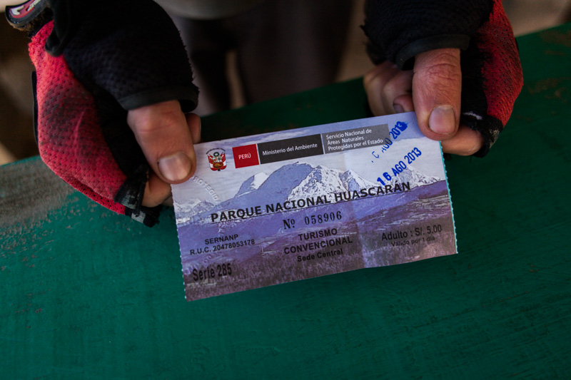
The time and the place. Huascaran National Park, northern Peru.
The loop:
Carhuaz to Punta Olympica to Chacas to Yanama to Portachuello Llanganuco to Yungay. 3.5 days or so. Lots of camping potential on the way up the passes, or cheap digs + food in Chacas and Yanama.

Unbelievable, Mr. Cass, unbelievable. The tones within the landscape are beautiful; rich browns highlighted by subtle gold and bluebird skies. Thanks for taking us along your journey as usual.
I’m glad you enjoyed the post, Eugene. It sure makes a change from New Mexico – which is just as beautiful in its own way (-;
I really like the picture of the locals.
I’m sure Sage would have had fun playing with the kids (-:
Absolutely stunning photos, as usual. I am itching to get down there to see it in the flesh. We’ve just crossed into Honduras (Copan Ruinas) today and we’re cursing the heat of the lower elevation after six weeks in the GT highlands. We’re considering fast tracking some of Central America to avoid riding in the heat.
Looking forward to more posts from your trip!
I don’t miss that low elevation Central American heat! But do take time for a detour around Nicaragua’s Isla de Ometepe. As the boat draws closer to its perfectly formed volcanoes, it feels like you’re approaching Jurassic Park…
I hope your new seatpost holds out ok! (and wheel too!!)
Cass,
Freaking unbelievable shots!!!! AMAZING SCENERY!!! Truly huge thanks for sharing with us;) It looks very reminiscent of the Indian and Nepali Himalayas…
BTW, do you save your GPS tracks somewhere online, like Strava or Garmin website??? It’d be super helpful to see the routes you’ve biked on down there;)
Keep the pictures coming and tailwinds all the way… Rich
Rich – thanks! I’m not recording gpx tracks day to day, as it means leaving the iPhone on. But I will try and make a concerted effort to clock more unusual routes. The area is definitely up there with the best of the Himalayas!
Cass,
I looked at this route on GE one time. Glad to see pics of its steeps and real life mountains. Not to mention the small towns. I wondered if I had the area right. Here’s a GE snapshot of where I thought you went. http://www.flickr.com/photos/98604042@N03/9552467804/
Dan
Wrong one. Here: http://www.flickr.com/photos/98604042@N03/9549775705/in/photostream
Anyways. Impressive ride. Looks awesome too.
Dan, it’s a little hard for me to see from the map. But basically, the ride starts in Caruaz (or Huaraz). The paved road climbs up and over Punta Olympica to Chacas. Around 12km after Chacas, there is a dirt backroad to Yanama, which leaves the main (paved) road before it reaches San Louis. From Yanama, it’s simply up and over Portachuelo de Llanganuco (again, dirt), to Llanganuco lake. Beyond the exit to the park, there are two roads to Yungay – we took the more southerly option as it’s been graded more recently.
Eventually, this brings you out in Yungay, where there are shared minibuses back to Huaraz. Or you can ride – it’s around 55km, climbing from 2500 to 3,100m on the main road.
Awesome pictures and trip accounts on your blog. I’ve been looking at the Tarptents. How do you like yours? Protection from the weather? Why did you go with the model that you did? Thanks for your time and have a great time!
Josh, mine’s the Tarptent Moment. I have the extra pole too, so it can be pitched freestanding – which is really handy, and it provides extra bracing in high winds. I had a Rainbow before, which I actually marginally preferred – mainly, as it didn’t feature integrated poles, so it could be packed into a ball-shape in my seat pack. For bike touring, that’s my main issue with the Moment – it has to be rolled away into a tube, which limits how you can carry it. But then again, it’s free standing, and the Rainbow isn’t…
As with a lot of lightweight gear, bear in mind that the zips are on the small side, and it needs to be treated with care. I always roll out a piece of Tyvek as a groundsheet to protect the floor.
Overall, it gets a thumbs up from me!
Great pictures! Fond memories of the Cordillera blanca.
beautiful!
Definitely Scottish moments in there…
Amazing post! I am experienced with lengthy tours and leaning toward a trip in the Andes in Peru, was hoping I could ask about the best time of year and how accessible the prime areas are, like the Cordillera Blanca environments that have trekking routes, are most of these open to bikes as well? Any thoughts, resources would be greatly appreciated (other than your posts, obviously)…
Hi Christopher, best bet is to check this excellent guidebook from Trailblazer.
http://trailblazer-guides.com/book/peru-cordilleras-blanca-huayhuash-hiking-biking
Should answer all your questions!